» posted on Sunday, July 7th, 2013 by Linda Lou Burton
Pretty As A Picture
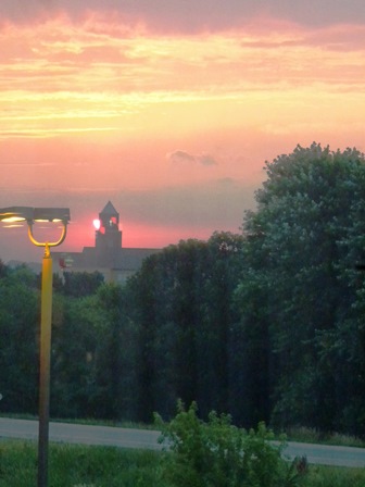 Linda Burton posting from Saint Paul, Minnesota – The sun was up at 5:47, and I was too. I got the first load into the car even before the outside lights shut down; I was determined to beat the heat. Four loads and one orange juice later, we were on the road. The cats went back to sleep right away; I nibbled on the blueberry muffin I’d grabbed, and enjoyed the ease of the drive. A blue sky, a highway stretching straight in front of me, and mile after mile of corn; I could almost hear it growing. If I were a photographer, this is where I’d come for my postcard shots; the farm scenes were pretty as a picture – farmers
 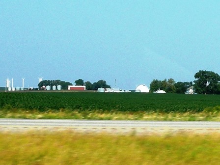 houses tucked in their own personal clump of trees; their barns and silos near; all set in their personal fields of green. I-35 north from Des Moines to Saint Paul, 244 miles on a Sunday in July. I passed the sign to Ames, home of Iowa State University; a little further west is the birthplace of Mamie Doud Eisenhower. It must be hilly there in Boone County; The Boone & Scenic Valley Railroad is there, and Ledges State Park. I stopped for gas in Thornton, two miles off the freeway; no fountain drinks but the friendly lady
  behind the counter directed me to the ice cream freezer where she kept a bag of ice and a scoop; with her scissors she enlarged the hole in the coffee cup lid so I could poke the straw through for my ice-cold Coke. “Too hot for coffee,” we agreed. She was intrigued by the car; wanted to hear about the Journey. I asked about the giant storage silos in the middle of town. “Corn, and soybeans,” was the answer.
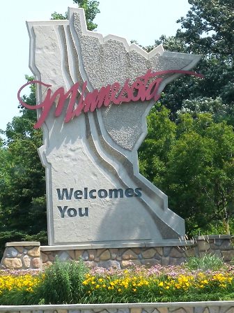 I entered wind farm territory at the northern edge of the state; I passed Clear Lake, and crossed the Winnebago River. And then, the Minnesota state line. The difference was evident right away; more small towns, and closer together; more lakes. A tall-spired church; Round Prairie Lutheran, it said on the sign. I crossed under I-90; a road I’ve traveled so much in the past; it begins in Boston and ends in Seattle; I actually watched the last few miles of its construction from my kitchen window in 1984. I passed a sign to St Olaf
 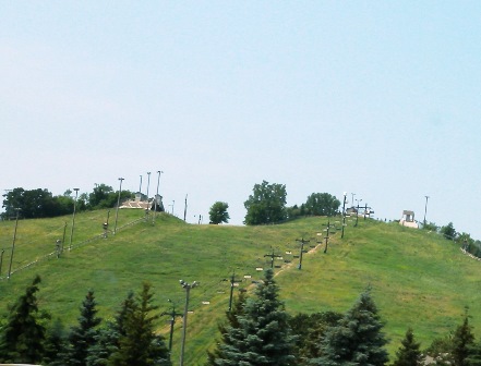 College; it reminded me of Betty White and her role on Golden Girls; she referred to St Olaf in almost every episode, and told her tales of Minnesota life. Pointy fir trees began to appear; a sign warned of “snowmaking equipment ahead” which made me laugh in the heat; in truth there was a ski lift to my left; empty chairs on a hillside that was green today.
More lakes. It’s called the Land of 10,000 Lakes, but somebody has counted 11,842 that are over 10 acres in size; with all its rivers and streams, Minnesota has more wetlands than any state except Alaska. The Mississippi River begins in Minnesota; in fact, two major drainage divides form a triple watershed. There’s the Mississippi River south to the Gulf of Mexico; the 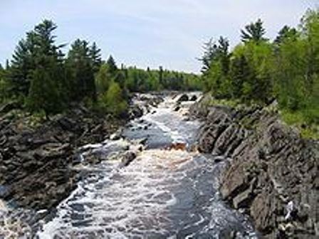 Saint Lawrence Seaway east to the Atlantic Ocean, and the Hudson Bay watershed north to the Arctic Ocean. Minnesota is the northernmost state (again, except for Alaska); a tiny chunk actually extends beyond the 49th parallel. Minnesota has some of the oldest rocks in the world, gneisses over 3 billion years; Minnesota has been hot and cold; basaltic lava and volcanic mountains forming the Iron Range; massive ice sheets cutting into bedrock; steep hills and streams; glacial till.
Traffic began to thicken as I approached Burnsville; the GPS directed me to follow I-35 West; my hotel is in Bloomington, about ten miles from the capitol in Saint Paul (nothing pet-friendly any closer). I’ve been “west of the Mississippi” since I crossed into Missouri May 21st; now for the trickiest “Capital City Trivia” question of all. How many capital cities are east of the Mississippi River? The answer is 28. And how many are west? The answer is 23. You will notice that brings a total of 51. Saint Paul, you see, is on BOTH sides of the Mississippi River! The capitol building is on the east side, but a section of the incorporated city is across on the west side as well. Bloomington, however is west, so I’ll be crossing back and forth over the river during my stay.
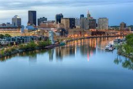 Saint Paul, with a population of 285,068 (US 2010 Census), is the 13th largest capital city, a fact which belies the reality of the number of people in the area. It is one of the “twins” in the Twin Cities, adjacent to Minneapolis; the two are surrounded by suburbs such as Bloomington, Burnsville, and Eagan to the south; Minnetonka, Eden Prairie, and Plymouth to the west, Coon Rapids, Blaine, Fridley, and Arden Hills to the north; Maplewood, Oakdale, and Woodbury to the east. There is West Saint Paul, North Saint Paul, South Saint Paul, and just plain Saint Paul. Add it up and you have a metro area of over 3.3 million people. European settlers were primarily Scandinavian and German; today the city’s makeup is 56% White, 10% Hispanic, 16% Black, and 15% Asian, making it the 3rd highest Asian-populated capital city, after Honolulu and Sacramento. A high percentage are Hmong immigrants from Vietnam, Laos, Cambodia, Thailand, and Myanmar; Saint Paul is the location of the Hmong Archives.
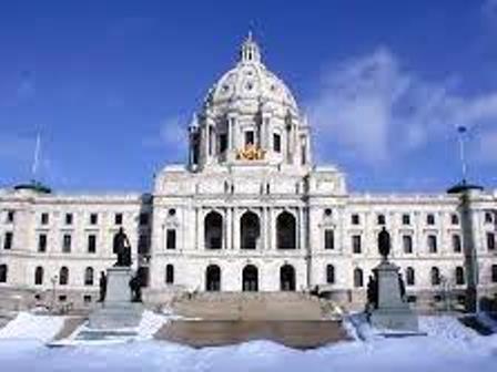 Saint Paul boasts being one of the most literate and one of the healthiest cities in the country; it also lays claim to being the coldest, with an average annual temperature of 45.4F. Cold Arctic air grabs hold in the months of December, January and February. But today, it’s July hot; I reached my hotel before 1 PM and quickly got the cats inside. We took an air-conditioned nap; I finished unloading in the cooler evening air. But the skies are clear and only one stormy day is predicted for the next week. I’ll have over fifteen hours of summer daylight every day; plenty of time to enjoy cruising the Mississippi River, shopping the Mall of America, and meeting new people in Saint Paul, Minnesota, another pretty-as-a-picture place.