‘Little Rock’ Category
» posted on Monday, July 25th, 2022 by Linda Lou Burton
Alice’s Wonderland
Originally Published July 25, 2020 by Linda Lou Burton posting about Alice Springs, Australia from Little Rock, Arkansas – I won a spelling bee in 5th grade with the word “aborigine.” I didn’t know the meaning, so Miss 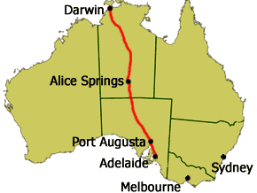 Hudson had me look it up. That’s when I decided I’d visit Australia. So I am going to Alice Springs, and I am going to Uluru. I catch a Qantas ride this morning (on my NDI RTW); two hours to cover the 952 miles from Adelaide to the very center of the continent. I’m booked tonight at the AS Hilton with a view of the MacDonnell Mountain Range just out my window. The plan: get there in time for lunch. Winter is the best time to visit the Red Center; mornings and evenings are cool; days are sunny and warm.
The Tourism Australia website tells me this is what I will find.
- A true Aussie outback town in the heart of Australia’s Red Centre
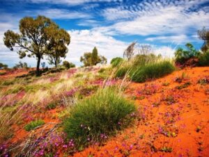
- A sweeping horizon, burnt red dirt, and rugged mountain ranges
- A deeply spiritual and passionate Aboriginal community
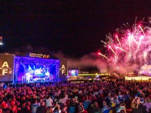
- A stunning arts scene and fun and quirky festivals
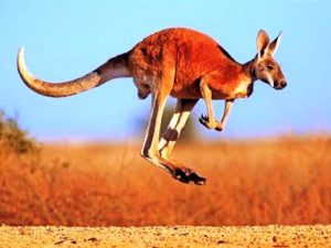
- A sanctuary for orphaned kangaroos
https://www.australia.com/en-us/places/alice-springs-and-surrounds.html
A True Aussie Town & How It Grew
 Alice Springs is Australia’s geographic center, right between Adelaide and Darwin. The Red Center is an arid environment – annual rainfall 11 inches – consisting of several deserts. It’s known as Mparntwe to its original inhabitants, the Arrernte, who have lived in the Central Australian desert for tens of thousands of years.
European exploration began when John Stuart led an expedition through Central Australia in the early 1860s. Ten years later a white settlement was started with the construction of a repeater station on the Australian Overland Telegraph Line (OTL), which linked Adelaide to Darwin and Great Britain. This opened the interior for permanent settlement. The Alice Springs Telegraph Station was built near a waterhole and named Alice Springs after the wife of the Superintendent of Telegraphs, Charles Todd. It was after gold was discovered in 1887 that significant European settlement occurred; it was 1929 when the train line to Alice was built that the town’s European population began to grow. Aboriginal Centralians outnumbered 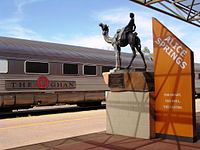 European Centralians until the mid-1930s.
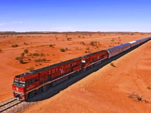
Camel trains were the original British-Australian transportation in the outback; operated by immigrants from then-British India (present-day Pakistan). Cameleers moved to Alice Springs in 1929 when the railway reached the town; they transported goods from the rail head to settlements to the north. The 1,849-mile Adelaide–Darwin railway was completed in 2004 when the Alice Springs-Darwin line opened. It is used by The Ghan passenger train and freight trains operated by One Rail Australia.
Who Lives There Now
 About 26,534 people live in the Alice Springs Urban Area. Aboriginal and Torres Strait Islander people made up 18% of the population. Aboriginal residents live in the suburbs, on special purpose leases or town camps, or further out at Amoonguna to the south and on small family outstation communities on Aboriginal lands in surrounding areas.
Americans have lived in Alice Springs since the establishment of the US Air Force Detachment 421 in 1954, as part of a joint American–Australian project called the Joint Geological and Geographical Research Station. Currently 2,000 residents of the Alice Springs district hold American citizenship. Several small immigrant communities have found a home in Alice Springs, including Vietnamese, Chinese, Thai, Sudanese and Indian ethnic groups.
Alice Springs has a large itinerant population composed of foreign and Australian tourists, Aboriginal Australians visiting from nearby communities, and Australian or international workers on short-term contracts working in stations, mines, healthcare and law enforcement.
The Terrain
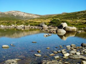
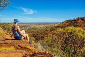 Arrernte country is rich with mountain ranges, waterholes, and gorges. The region consists of dry scrubby grassland and the MacDonnell Ranges which contain a number of hiking trails and swimming holes. The 139-mile Larapinta Trail follows the West MacDonnell Ranges and is considered among the world’s great walking experiences. The Simpson Desert southeast of Alice Springs is one of Australia’s great wilderness areas containing giant red sand dunes and interesting rock formations.
The Modern Town
The modern town of Alice Springs has European and Aboriginal influences. The Todd Mall hosts a number of Aboriginal art galleries. Alice Springs has many historic buildings, including the Overland Telegraph Station and Adelaide House, a beautiful stone building that was Central Australia’s first hospital; now a museum, it was built in 1926 by John Flynn, founder of the world’s first flying doctor service. A dispatch centre for the Royal Flying Doctor Service of Australia operates here. https://www.rfdsalicesprings.com.au/
The town is an important tourist hub and service center with several large hotels, a convention center, and a range of attractions, restaurants, and tour services. Alice Springs has nineteen public and private schools; School of the Air delivers education to students in remote areas.
The Stunning Arts Scene & Quirky Festivals
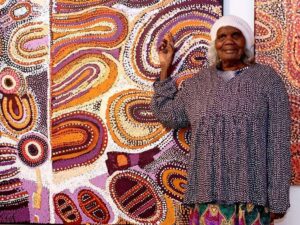 Alice Springs has a big reputation for Aboriginal art. Many diverse art galleries showcase one of the oldest living traditions in the world; contemporary art works tell traditional stories; superb dot paintings and watercolours by some of Australia’s most successful and prominent Aboriginal artists, including Barbara Weir, Minnie Pwerle and Albert Namatjira. A range of galleries line Todd Mall; the Araluen Arts Center is the hub of the visual arts scene. Read about the collections, the work done there, the public art, and the sacred sites, such as the hills that represent the dreaming of the Two Sisters, and the sacred 300-year-old corkwood tree. https://araluenartscentre.nt.gov.au/your-visit
Two quirky festivals of note: the Camel Cup and the Henley-On-Todd Regatta. Yes, July’s Camel Cup is just that, a day of really fun camel racing. And the Henley-On-Todd Regatta is a “boat” race in the dry sandy bed of the Todd River. It is the only “dry” regatta in the world, and yes, back in 1993 it was “called on account of rain.”
Orphaned Kangaroos
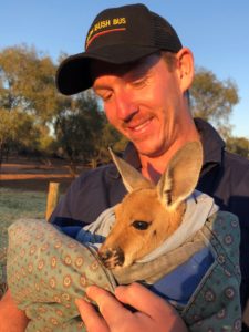 A Kangaroo Sanctuary with guided sunset tours through a 188-acre wildlife reserve; meet and feed rescued baby and adult kangaroos. Animals Come First is the motto; founder Brolga Barns says “Our mission is to educate and encourage people to rescue and care for kangaroos and other wildlife.” Kangaroo Dundee, a BBC/Nat Geo Series, is filmed here; shown in over 90 countries and now in its third series. Donations welcome. https://kangaroosanctuary.com/
I’m glad I was in that spelling bee, back in 5th grade. You never know how far a single word can take you.
» posted on Sunday, July 24th, 2022 by Linda Lou Burton
All About Adelaide
Originally Published July 25, 2020 by Linda Lou Burton posting about Adelaide, Australia from Little Rock, Arkansas – It’s hard to leave Adelaide. I would have scheduled a much longer stay for the RTW, but, when you have only a week to visit an entire continent the size of the US, you have to keep moving. And the mysterious Outback calls.
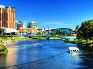 But before I leave, let’s talk about Adelaide, the capital city of the state of South Australia. It’s not only a great place to visit, it’s an even better place to live. It consistently ranks in the Top 10 of “World’s Most Livable Cities” as surveyed by the Economist Intelligence Unit, which measures a city’s Stability, Infrastructure, Education, Environment & Culture, and Healthcare (both quality and availability). Melbourne and Sydney also ranked in the Top 10, you can’t go wrong in Australia!
Pristine beaches and world-class vineyards don’t hurt a city’s livability quotient, nor does a moderate climate with hot dry summers and mild cool winters. South Australia has two nicknames – The Wine State and The Festival State – and I promised to tell you which I found to be most true. The answer: both are well-deserved!
South Australia’s Wine
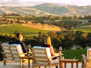 Adelaide is not only South Australia’s capital city, it is the wine capital of Australia – and one of the nine Great Wine Capitals of the World, alongside Bordeaux in France, Napa Valley in the US and Bilbao Rioja in Spain. There are 18 wine regions in South Australia, here is just a sampling:
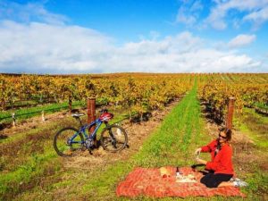
- Barossa. Over 80 cellar doors, along with five-star retreats. Due to its Mediterranean climate Cabernets and Shiraz’ are unbeatable.
- McLaren Vale. Over 70 cellar doors only 40 minutes from Adelaide, close to stunning coastal vistas. World-class Shiraz, Grenache, Cabernet Sauvignon, Chardonnay.
- Clare Valley. Over 40 cellar doors just a scenic 90 minute drive from Adelaide; the Riesling and Rattler Trail cycle path winds through the countryside.
- Coonawarra. The Coonawarra is Australia’s top producer of premium red wines. Its wineries also sell some of the best local produce available.
- Adelaide Hills. 60 wineries just minutes from Adelaide and one of Australia’s best cool-climate wine regions.
The University of Adelaide’s National Wine Centre is the showcase for the Australian wine industry. It provides important links with the wine industry, is an important platform for wine education and research, and provides a world class venue for food and wine. A visit there shows the winemaking process from vine to bottle; the Wined Bar offers over 120 wines for tasting. Nestled in the city’s Botanic Gardens. https://nationalwinecentre.com.au/
South Australia’s Festivals
 Go back to 1960, when the Adelaide Festival of Arts was established with backing of the city and city businesses. Then along came the Adelaide Fringe – an unofficial series of performances and exhibits. In 1970 construction of the Adelaide Festival Center began; add the South Australian Film Corporation in 1972, the State Opera of South Australia in 1976. It all kept growing.
The Adelaide Festival expanded to include Adelaide Writers’ Week and WOMADelaide, an open-air festival in Botanic Park celebrating the World of Music, Arts & Dance. Then came the Adelaide Cabaret Festival, the Adelaide Festival of Ideas, the Adelaide Film Festival, FEAST, Tasting Australia (food and wine, yum). Ever heard of MAD MARCH? Combine the Festival, the Fringe, WOMADelaide, Writers’ Week and the Adelaide 500 street motor racing event, along with evening music concerts all happening at the same time, and you have earned a sure-enough festival reputation.
There are also many international cultural fairs in Adelaide, such as the German Schützenfest and Greek Glendi. The Adelaide Christmas Pageant includes the southern hemisphere’s largest Christmas parade. Yes, Santa shows up in a beard and the floats are decorated with snowmen, though it is warm-weather time there.
There are too many live music and theatre venues to count; Lonely Planet labeled Adelaide “Australia’s live music city,” and Adelaide was recognized as a “City of Music” by the UNESCO Creative Cities Network.
- Next Adelaide Festival 26 Feb – 14 Mar 2021 https://www.adelaidefestival.com.au/
- WOMADelaid https://www.womadelaide.com.au/
- Adelaide November Christmas Pageant https://www.christmaspageant.com.au/
So what do you think? Is South Australia The Wine State, or The Festival State?
As for the capital city of Adelaide, I haven’t yet mentioned EDUCATION (an educational hub, it’s known as a Learning City, three Nobel laureates completed education at St Peter’s College and the University of Adelaide), or SPORTS (home of two Australian Football League teams and one A-League soccer team).
But you should know this HISTORY of Adelaide, population today 1,345,777.
- Named for Queen Adelaide
- Founded in 1836 as the planned capital for the only freely settled British province in Australia
 Located close to the River Torrens in the area originally inhabited by the Kaurna people and known as Tarndanyangga, place of the red kangaroo
- Designed by William Light in a grid layout, interspaced by wide boulevards and large public squares, and entirely surrounded by parklands
The new city attracted immigrants from many parts of Europe; German Lutherans in 1838 brought vine cuttings with them that were used to found the wineries of the Barossa Valley; other Europeans escaping religious persecution were attracted to a city founded on religious tolerance; it’s known today as a City of Churches. St Francis Xavier’s Cathedral was consecrated in 1858; the Central Adelaide Mosque, built to accommodate the spiritual needs of Afghan cameleers, is Australia’s oldest permanent mosque.
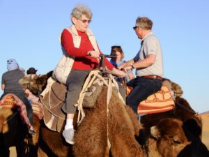
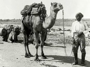 Which leads to one last historical tidbit, as I prepare to head north to the “red center” of Australia. The Afghan community in Australia became established in the 1860s when camels and their handlers were used to open up settlement in the continent’s arid interior. Until the advent of railways and motor vehicles, camels played an invaluable economic and social role in transporting heavy loads of goods to and from isolated settlements and mines.
Now you know why the passenger train between Adelaide and Darwin came to be named The Ghan, a story I’ll tell more about tomorrow, from Alice Springs.
» posted on Saturday, July 23rd, 2022 by Linda Lou Burton
River Murray & The Adelaide Hills
Originally Published July 24, 2020 by Linda Lou Burton posting about Adelaide, Australia from Little Rock, Arkansas – Wellington to Melbourne to Adelaide in six hours yesterday, no worries, mate. A good night’s sleep at the Adelaide Hilton, downtown on Victoria Square. The NDI RTW continues (Now Defunct Imaginary ‘Round The World) this morning when the tour bus picks me up out front.
 Adelaide Sightseeing it is. I am booked for a full-day River Murray Highlights Tour because, well because I love rivers. And the River Murray is on my Bucket List. I aim to cruise the longest river on every continent, and the Mississippi is the only one I can count, so far. I’ve even been through Lock #1 at St Paul! https://capitalcitiesusa.org/?p=11157/ There is no cruisable river in Antarctica, of course. But later trips will get me to South America’s Amazon, Asia’s Yangtze, and Europe’s Volga. Africa’s Nile is scheduled for this trip, but today, it is Australia’s River Murray.
The goal is not to cruise the full length of any of these rivers. It is just to be ON them for a while, to learn about them, and how they impact their part of the world. Rivers MOVE, they get somewhere. They DO something. They support life. We drink out of our rivers, and, yuck, we dump our wastewater into our rivers. Our rivers have the power to make electricity for us, and, where they are allowed, they deposit silts and nutrients on our soil to help things grow. They shift the land around, and change their course when they see a better route. And our rivers are built-in highways! Before roads, or trains, or planes, rivers moved people; today river commerce is an important part of our economy.
So how does the River Murray impact Australia? Here’s what the South Australia Department for Environment and Water tells us: https://www.environment.sa.gov.au/topics/river-murray
The River Murray, 1,558 miles long
 South Australians live in the driest state in the driest inhabited continent in the world. The River Murray is the life-blood of the state, providing essential water for irrigation, industry, domestic and recreational use and our precious wetlands and floodplains. In South Australia, in an average year, around 75 per cent of the water taken from the River Murray is used for primary production. This includes water for livestock, piggeries, dairies and wineries and for the irrigation of crops such as citrus, stone fruit, almonds, pasture, vegetables and other niche crops.
Other water uses include water supply for towns and metropolitan Adelaide, the environment and recreation. The river is also a popular place to visit and enjoy the beautiful locations, unique plants and wildlife, quality food and wine and outdoor activities.
The Murray-Darling Basin
 The River Murray headwaters are near Mt Kosciuszko, Australia’s highest point (7,310 ft), snow melt and rainfall drain down the western side of the Australian Alps, then the river meanders across Australia’s inland plains, forming the border between the states of New South Wales and Victoria as it flows to the northwest into South Australia. It is joined at Wentworth by the Darling River, then turns south at Morgan for its final 196 miles. The water of the Murray flows through several terminal lakes including Lake Alexandrina and The Coorong before emptying through the Murray Mouth into the Indian Ocean. The mouth is
 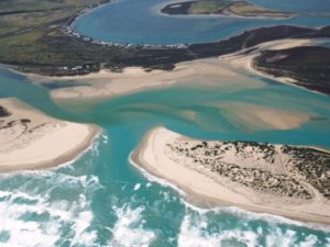 comparatively small and shallow, and dredging machines move sand from the channel to maintain a minimal flow from the sea and into the Coorong’s lagoon system. The lack of an estuary means that shipping cannot enter the Murray from the sea.
The Murray-Darling Basin includes the Australian Capital Territory, and parts of Queensland, New South Wales, Victoria and South Australia. The basin supports agriculture, tourism and other productive industries and is home to more than two million people. Outside the basin, a further 1.3 million people depend on its water resources, including Adelaide, the largest population base reliant on basin water resources. Drought, of course, is always a concern.
The Proud Mary
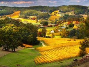 As for my Huck Finn river day, I’ll first see the river at Mypolonga, a settlement in South Australia on the bank of the lower Murray River; its name is from an Aboriginal name for Cliff Lookout. It’s about a 55-mile drive from my hotel in Adelaide, winding through the beautiful area known as the Adelaide Hills, famous for its cool-climate wine. The Proud Mary is our paddle-wheeler, Mississippi riverboat style; and a buffet lunch is part of the fun as we glide past stunning orange cliffs and weeping willows, watching for pelicans, cockatoos and cormorants; listening
  to commentary about the river’s history, and significance.
Abundant wildlife, spectacular scenery, beautiful skies and an overwhelming sense of tranquility.
Promised, and delivered. On the ride back to Adelaide, a stop at Melba’s Chocolate Factory, and Woodside Cheese Wrights at Woodside.
I am counting my blessings.
Adelaide Hills https://southaustralia.com/places-to-go/adelaide-hills
The Proud Mary, 2-day and 5-day cruises too. https://www.proudmary.com.au/
Melba’s Chocolate Factory https://www.melbaschocolates.com.au/factory/
Woodside Cheese Wrights, Kris Lloyd, Artisan https://krislloyd.com.au/
Special Note
Due to COVID-19, restrictions are in effect for travel in Australia. I offer a special note of THANKS to Adelaide Sightseeing for contacting me about the cancellation of my planned tour, and kindly refunding in full my payment for what would have been a delightful day, I’m sure. Very kind, great business practices.
Adelaide Sightseeing https://www.adelaidesightseeing.com.au/
» posted on Friday, July 22nd, 2022 by Linda Lou Burton
Crossing The Ditch
 Originally Published July 23, 2020 by Linda Lou Burton posting about Adelaide, Australia from Little Rock, Arkansas – The plan for Thursday, July 23. Sleep late. Morning walk. Lunch at the Intercontinental. Check out. Wellington Airport. Board a Qantas. (Always loved that name!) Fly to Adelaide, Australia. Let’s keep my now-defunct-due-to-COVID19-RTW in the present tense today, it helps with the imagining.
Leaving Wellington is hard to do. But then, I am heading for a major Bucket List Tick – my sixth continent! Born in North America, got to South America and Antarctica in 2005, made it to Europe and Africa in 2019. 2020 is the year for Australia and Asia, all SEVEN CONTINENTS finally under my belt. Or feet, more properly put. Walk on all seven continents. Check it off!
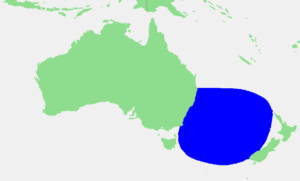 But today, I have to cross the Tasman Sea. Folks in that part of the world call it “The Ditch.” It’s about 1,400 miles of water between New Zealand and Australia, and water being what water is, no fences define it, though geographers will tell you the Coral Sea and Pacific Ocean are to the north, the Cook Strait (that’s the water between New Zealand’s two main islands) to the east, the Southern Ocean to the south, and Bass Strait to the west – that’s the bit that separates Tasmania and the Australian mainland. Got that?
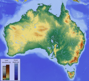
There is so much to tell you about Australia. It is the oldest, flattest, driest inhabited continent on earth! And it is both a continent, and a country. It has six states, and two territories. It is almost the size of the United States. I am googly-eyed to get there.
ACT – Australian Capital Territory. Area 910 square miles. People 427,419. Capital Canberra.
Like the United States, Australia has set aside a portion of itself to serve as the nation’s capital. The spot was voted on, chosen (though not without heated discussion, of course), and the capital city of Canberra was built from scratch. The ACT is in the southeast part of the country between the state capitals of Sydney and Melbourne, an enclave within the state of New South Wales. More about Canberra, of course I’ll visit there.
NSW –New South Wales. Area 309,130 square miles. People 8,128,984. Capital Sydney.
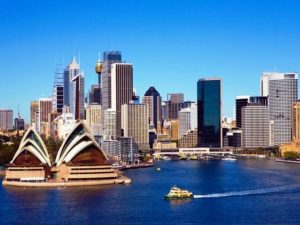 Everyone has seen the photo of the Opera House in the Sydney harbor, and it breaks my heart that I can’t fit Sydney within my RTW timeline. My parents raved about the city when they visited years ago, so I’ll have to let their footprints serve for me. Sydney is not only capital of New South Wales, it is also Australia’s most populous city. NSW edges Australia’s east coast, such a pretty state, with beaches, agricultural plains and highlands in the middle, and the Snowy Mountains to the west. Yes, they have skiing there. Nicknamed The First State, NWS was originally founded as a British penal colony. That was 1788. Just look at it now!
QLD – Queensland. Area 715,309 square miles. People 5,129,996. Capital Brisbane.
 Queensland is huge. I’m not kidding, only 15 COUNTRIES in the entire world are bigger than the state of Queensland in Australia (which is the 6th largest country). And Queensland is diverse. It has mountains. It has tropical rainforests. It has deserts. It has sandy beaches, and yes, Queensland is where you go for those world-famous Pacific waters coral reefs, if diving is your thing. Its nickname is The Sunshine State, its capital is Brisbane and sadly, I’m not visiting Queensland either. I do have a friend there though! I met Jennifer last year on my trip to Portugal-Spain-Morocco (yes, she rode the camel in the Sahara) and loved hearing her stories of farm living – flying off to boarding school as a child; koalas in her back yard when her kids were growing up. So, hi Jennifer! Thanks for sharing a taste of Queensland with me.
VIC – Victoria. Area 91,761 square miles. People 6,651,074. Capital Melbourne.
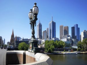 I am headed for Victoria as Melbourne is my first stop beyond the Tasman Sea. The state is small, but lots of people live in The Garden State (wheat, barley, pears, apples, asparagus, broccoli, carrots, potatoes, tomatoes in abundance). With the Australian Alps to the east and the Little Desert to the west, the OMG city of Melbourne sits midway, right on the harbor; Australia’s busiest seaport. Architecture ranges from 1800s Victorian to high-rise modern (52 skyscrapers!). It has the country’s most extensive network of freeways and the largest urban tram network in the world. Tullamarine Airport is where I’ll be changing planes often, wait and see how many times I stop here!
TAS – Tasmania. Area 26,410 square miles. People 537,012. Capital Hobart.
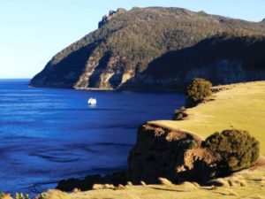 Tasmania is Australia’s smallest state, situated directly south of Victoria across the Bass Strait. There is a main island, with the capital city of Hobart in the southern part; but the state also includes 334 surrounding islands. Tasmania’s fascinating history of geology, peoples, settlements, and colonization make it a place I’d love to know more about and wish I had time to visit. It is generally Australia’s coolest spot, thanks to Southern Ocean breezes; maybe the reason for its nicknames – The Apple Isle and The Holiday Isle.
SA – South Australia. Area 402,903 square miles. People 1,759,184. Capital Adelaide.
 I’m spending two nights in Adelaide, South Australia’s capital city. Some of the driest parts of the country are in SA, but the Adelaide area has plenty of water. One is the nearby Murray River, one of my reasons for stopping here. South Australia seems to have two nicknames – The Festival State and The Wine State. I’ll let you know which I find most appropriate after my visit, either one sounds like a party!
WA – Western Australia. Area 1,021,478 square miles. People 2,639,080. Capital Perth.
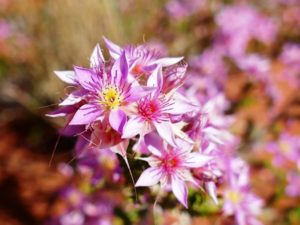 Queensland is huge, but Western Australia is REALLY huge. It makes up the entire western third of Australia! It touches two oceans – the Indian and the Southern. The Tropic of Capricorn runs across the middle of it. The Great Victoria Desert and The Great Sandy Desert sit on either side of that. If you stand at the edge of Kansas and look west to the Pacific, you’ll sort of get the idea of WA’s vastness. It seems to have two nicknames, The Wildflower State and The Golden State; that last one makes me think of California. I’ll tell you much more about WA when I visit the capital city of Perth, my last stop on my 6th continent.
NT – The Northern Territory. Area 548,640 square miles. People 244,761. Capital Darwin.
 I’m putting NT last on this list because it is officially a territory, and not a state. But I’ll be making two stops in this incredible, almost-other-worldly place I’ve been longing to see for years. My two stops are Alice Springs and Uluru – I’ll tell you all about them later. Sadly, Qantas connections just didn’t work timewise to get me to the capital city of Darwin, a grievous fact! And The Ghan, the train that runs between Adelaide and Darwin, runs just twice a week. Nickname for the NT — The Territory. Natch.
I’ve made a solemn promise – I’m not only going to reschedule my RTW when COVID-19 restrictions end and the world is safe for travel once again. I’m going back even after THAT, to stay at least a month in the Land Down Under.
And that’s my story, as I imagine myself flying across The Ditch.
» posted on Thursday, July 21st, 2022 by Linda Lou Burton
From the Queen Bee to the MMP
 Originally Published July 23, 2020 by Linda Lou Burton posting about Wellington, New Zealand from Little Rock, Arkansas – This is a major election year in the United States, with politics running hot and uncertainty running high under the shadow of COVID-19. As I’ve studied the island nation of New Zealand these last few days, I found that 2020 is an election year there too – they do it every three years. So I dug in to see how it’s going.
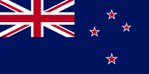
 I learned that New Zealand ranks high in civic participation, with almost 80% voter turnout in recent elections. Considered one of the world’s most stable and well-governed states, the country is a constitutional monarchy with a parliamentary democracy, and Elizabeth II is the queen of New Zealand and therefore head of state.
Now hang on and follow this trail, remember that the Beehive in Wellington is comparable to the US Capitol in Washington, DC. Here goes:
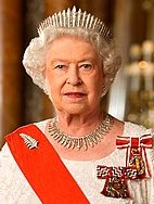
Head of State
As Head of State of New Zealand, the Queen has a range of royal powers which include signing bills into law, formally appointing governments and Ministers, appointing judges, and opening and dissolving Parliament.
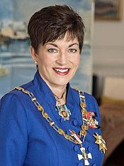 Her representative, the Governor-General, currently Dame Patsy Reddy (2016), has full authority to act on the Queen’s behalf when the Queen is not physically present in New Zealand. Make note: The Queen has visited New Zealand on only ten occasions since 1953, the last in 2002.The Constitution Act states that the Queen, or the Governor-General, can only exercise any of the royal powers with the advice and consent of the Government of the New Zealand.
Head of Government
The New Zealand Government is the central government through which governing authority operates, within the framework “the Queen reigns, but the government rules, so long as it has the support of the House of Representatives.”
Parliament consists of the Sovereign, (the Head of State) and the House of Representatives, (the elected legislature.) Parliament has 120 seats.
 The Prime Minister is New Zealand’s head of government, with the authority to lead the government while answering to Parliament. The Prime Minister is formally appointed by the Governor General, based on agreements between parties and internal leadership votes. Jacinda Ardern (2017) serves as the current Prime Minister, an elected member of the Labour Party – the largest party in the coalition Government formed after the 2017 elections.
Political Parties in New Zealand
There are five parliamentary parties in the 52nd Parliament.
- The ACT Party has one member of Parliament. Read more
- The Green Party of Aotearoa / New Zealand has 8 members of Parliament, all from the party list. Read more
- The New Zealand Labour Party has 46 members of Parliament, 17 elected from the party list and 29 electorate seats. Read more
- The New Zealand National Party has 54 members of Parliament, 15 elected from the party list and 39 electorate seats. The National Party is in Opposition. Read more
- The New Zealand First Party has 9 members of Parliament, all from the party list. Read more
The MMP
MMP is the voting system in New Zealand. It stands for Mixed Member Proportional. A registered voter gets two votes under MMP:
- A party vote for a political party to help choose how many seats in Parliament each party gets.
- An electorate vote for a candidate from the area the voter lives in.
 Every candidate who wins an electorate gets a seat in Parliament. They are called Electorate MPs. The remaining seats are filled from party lists. Every party has a list of candidates ranked in the order the party wants those candidates to be elected to Parliament. Candidates elected from a party list are called List MPs.
Usually no party gets enough votes to govern alone. Parties often need to come to an agreement with other parties to form a government or pass legislation. Some types of possible agreements are:
- coalitions — when two or more parties join together to form a government
- confidence and supply agreements — when one party agrees to support another on certain issues and laws that are voted on in Parliament.
Who Can Vote
You are eligible to enroll and vote if you are 18 years or older, a New Zealand citizen or permanent resident, and you’ve lived in New Zealand continuously for 12 months or more at some time in your life. If you’re of Māori descent and enrolling for the first time, you may enroll on the general roll or the Māori roll to choose which electorate you vote in.
If you’re in New Zealand, you’ll be able to vote from Saturday 5 September to 7pm on election day, Saturday 19 September. Voting places will open across New Zealand, so everyone has a chance to vote. You can vote from overseas from Wednesday 2 September.
At the 2020 General Election, you can vote for the parties and candidates you want to represent you in Parliament, and you can vote in two referendums: whether the recreational use of cannabis should become legal, and whether the End of Life Choice Act 2019 should come into force, giving people with a terminal illness the option of requesting assisted dying.
Making It Safe To Vote
Keeping everyone safe is essential. Voting will open 2 days earlier than usual, and there will be more voting places to reduce queues. Vote locally and bring your own pen if you can. Hand sanitizer will be provided at voting places, and there will be space for physical distancing. If you need to stay home, you’ll have other ways of voting including voting by post.
Preliminary election results will be released from 7pm on 19 September; official results for the general election and referendums will be released on Friday 9 October.
This information was taken from the following websites, an impressive and useful array of tools to keep New Zealanders informed:
- The Beehive, Official website of the New Zealand Government, https://www.beehive.govt.nz/
- New Zealand Parliament, business, calendar, electorates, visit and learn, https://www.parliament.nz/
- Political Parties in New Zealand, https://www.parliament.nz/en/mps-and-electorates/political-parties/
- New Zealand Government, the system, how it works, how to engage, https://www.govt.nz/
- New Zealand Electoral Commission, complete voting information with a special page devoted to COVID-19 concerns: https://vote.nz/
» posted on Wednesday, July 20th, 2022 by Linda Lou Burton
Beehive & Five
Originally Published July 22, 2020 by Linda Lou Burton posting about Wellington, New Zealand from Little Rock, Arkansas – Here’s what I’d choose to do on my second full day in Wellington, after the bus tour overview and the birds-eye view from the helicopter. Wherever I go, I try to see things I couldn’t see anywhere else in the world. I’d like to see everything, but time and a creaky knee keep me reasonable. So I pick and choose the “most uniquest!”
Parliament and The Beehive
The “capitol building of the country” is always top of my list, and here, that is Parliament House, with its supporting building, the Beehive.
Parliament House, in use since 1918, is Edwardian neoclassical in style, a distinguished building that features New Zealand materials such as Takaka marble; marble columns line the front. The building contains the debating 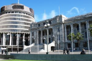 chamber, speaker’s office, and committee rooms. It is open to visitors most days, though access to the public galleries above the debating chamber are possible only when the house is sitting; a dress code applies.
The adjoining Beehive , completed in 1981, looks much like its clever name. Up top is the Cabinet room and the Prime Minister’s office; senior ministers are situated according to their ranking in Cabinet. Other facilities include function rooms, a banqueting hall, Pickwicks bar, Copperfields café, a theaterette used for press conferences, a gym, and a swimming pool! The country’s National Crisis Management Center is also located in this building. Guided tours available for both buildings; also educational visits for students.
https://www.parliament.nz/en/visit-and-learn/visit/
Te Papa
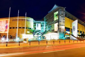 Wildly popular Te Papa is the national museum of New Zealand, six floors of cutting-edge interactive exhibits in an architectural wonder of a building. Its full name is Museum of New Zealand Te Papa Tongarewa, which translates to “container of treasures;” it is considered the home of New Zealand stories. Over 30 million people have come through since it opened in 1998; Trip Advisor rates it one of the top 25 museums in the world; Lonely Planet “one of the top 500 places on earth!” Te Papa’s clever, contemporary and bicultural approach puts it in a league of its own; the blend of artifacts and modern art powerfully shows how the nation’s heritage is so essential to modern-day culture. A good starting place is the Mana Whenua exhibit about New Zealand’s indigenous people, the Māori. The museum is open every day but Christmas and entry is free.
I would not miss this! https://www.tepapa.govt.nz/
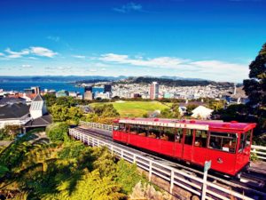
Historic Red Cable Car
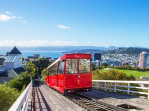 Never mind that the Red Cable Car is one of Wellington’s top tourist attractions; if I lived there I’d find a way to ride it at least once a week! Definitely an interesting way to get to work; imagine watching the seasons change from the seat of this charming vehicle, the cloud formations over the harbour, the sunset. A 5-minute ride leaving every 10-15 minutes from Lambton Quay, there is art too; murals at the terminal, active light installations in the tunnels, and a museum at the top. The Wellington Cable Car Museum is housed in the original winding house; two floors of exhibits tell the story of the cable car, in operation since 1902.
A must! https://www.wellingtoncablecar.co.nz/English/home.html
Zealandia
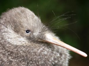 Zealandia is described as “a fully-fenced pest-proof urban island that is the closest thing you’ll find to being in New Zealand before humans arrived.” This pioneering eco-sanctuary just outside the city is an incredible slice of wilderness that turns back time on Wellington’s native environment. New Zealand was once an isolated land free from mammals, which meant native plants and birdlife flourished, including flightless kiwi. But with the arrival of humans came pests and predators, which caused the extinction of much wildlife and endangered many species. Two-hour tours with a guide; track down the rarest wildlife such as tuatara, prehistoric reptiles that have a real third eye, or giant weta that look like armored grasshoppers, or kererū, whose flapping wings sound like a helicopter! Night tours by torchlight might reveal glowworms, ruru owls, or the little spotted kiwi; end the evening with a cup of bushman’s tea.
A definite visit here; ranks high on the Most Uniquest scale. https://www.visitzealandia.com/
WETA Workshop
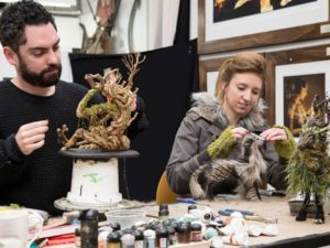 Wētā are giant flightless crickets, some of the heaviest insects in the world; something you’d see at Zealandia. The WETA Workshop is not about crickets though. It’s a design and manufacturing facility that turns out props, costumes, and creature effects for such Oscar-winning movies as Lord of the Rings and The Hobbit, also The Chronicles of Narnia, Avatar, Blade Runner 2049 to name a few. If you are among the millions of fans who love these movies, you’ve seen their work onscreen. I’m not, but I appreciate the craftsmanship and ingenuity it takes to make things that look so other-worldly and grand. Several tours, 45-minutes or full-day; watch people “just doing their work” in jobs that kids would die for.
Unique, for sure! https://www.wetaworkshop.com/
Hannah’s Laneway and Cuba Street
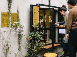 Hannah’s Laneway is Wellington’s little food haven. It’s right in the middle of town between Leeds and Eva Streets. Stop at the shop window of Fix & Fogg, for peanut butter tastings and gourmet toast, it takes its name from the classic Around the World in 80 Days characters Detective Fix and Phileas Fogg. Their peanut butter does go around the world – they ship to Australia, Singapore, the USA, beyond. Stroll on down the lane to Golding’s Free Dive (bar), Leeds Street Bakery, Wellington Chocolate Factory, Lashings (brownies!), Fortune Favours (brewbar), Shepherd (restaurant), Pizza Pomodoro, Hanging Ditch. Hanging Ditch is a cocktail bar where the range of liquor is, really, hanging – their bottles of booze are suspended from the ceiling, dangling overhead on bungee cords which the bartenders pull down to pour. Great selections of local beer and wine here too.
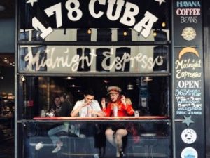 Cuba Street is Wellington’s most colorful street; get splashed by the famous Bucket Fountain (yes, buckets); discover quirky cafes, vintage clothing, record stores, art galleries. End the night at Midnight Espresso, one of the last places open late for midnight feasts; the café counter is piled high with vegetarian frittatas, pies, sandwiches, cakes and slices, flamboyantly decorated with fruits and flowers; the vast short-order menu is written large on the café wall; liquid refreshments are freshly squeezed juices and high-octane Havana espresso, of course.
My kind of quirky unique! https://fixandfogg.com/usa and https://www.wellingtonnz.com/visit/cuba-street/
» posted on Tuesday, July 19th, 2022 by Linda Lou Burton
Kia ora
Originally Published July 22, 2020 by Linda Lou Burton posting about Wellington, New Zealand from Little Rock, Arkansas – Ha! It is raining in Little Rock this morning, a soft, gentle rain, no thunder, no downpour. Only 79 degrees, here in July! I take credit for such a gentle day, because I am mentally in  Wellington today (where I had PLANNED to be before COVID-19 struck the world and shut down travel anywhere). Mentally, I’m taking note of differences, and similarities, between Little Rock and Wellington. I’ve already mentioned they are about the same in number of people, but with different seasons in effect, time to be out and about today differs by nearly five hours. Little Rock’s summer daylight will last 14 hours. Wellington’s winter sunrise happens just before 8 this morning; sunset occurs just after 5.
So, with not a minute to waste, I (would have) scheduled two tours in Wellington yesterday. A morning bus tour to get the highlights of the city up close. And an afternoon helicopter ride for a bird’s eye view of everything. That would mean that today I’m in the know about where I’d want to spend more time, and, a bonus, by listening to my guides, I’d have learned a very important word.
And that important word is Kia ora.
 Kia ora is generally pronounced KEE-au-ra but however it sounds the point is Hi! or G’day! Interchangeable as a salutation, or farewell, or even an expression of thanks, the New Zealand Ministry for Culture and Heritage website lists it as one of 100 Māori words every New Zealander should know. Yes, it is from the Māori language; the word “ora” as a noun means “life, health, vitality.” It’s an attitude; a way of life. It’s an inclusive, uplifting expression, kind of an “air hug,” a verbal smile.
 Kia ora, a beautiful word. You’ll hear it everywhere, and you’ll see it printed on everything from jewelry to doormats. It’s the name of Air New Zealand’s inflight magazine; and the greeting they sent me when they confirmed my reservation. And, when they had to cancel it.
So I’m really in Little Rock today. But here’s what I would have done yesterday, if I could have.
Morning By Land
Hammonds Wellington Sightseeing Tours, https://wellingtonsightseeingtours.co.nz/
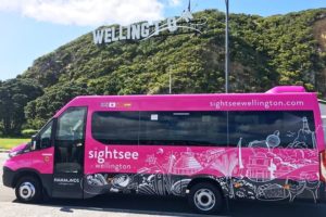 Just my style, friendly and down-to-earth tour guides for back and forth chats. A tour bus with focus on accessibility so I can get off and on with ease. Stops at places of great interest to me: New Zealand’s Parliament Buildings and Beehive. Old Saint Paul’s Cathedral. Wellington Botanic Gardens . Wellington Cable Car. Mount Victoria.
Afternoon By Air
Wellington Helicopters, GCH Aviation, https://gchaviation.com/wellington-city-scenic/
 A daring do in a windy city, but what could be better that flying over downtown Wellington and the harbour from the luxury of an EC130 helicopter? Nine minutes and a birds-eye view of iconic buildings such as Te Papa, the Beehive and the Cake Tin. Magnificent!
A nap after that, a fabulous dinner, a good night’s sleep. And then a day of focus, first stop, the Capital City stuff, like – the Beehive. That’s my next post, stay tuned.
Meanwhile, wherever you are and whatever your weather today, go to these websites that surely are the pride of New Zealand, so rich in information you won’t know where to stop.
Ministry for Culture and Heritage, Wellington https://mch.govt.nz/
- Dictionary of New Zealand Biography: The foremost reference work on the lives of people who shaped this country’s history. Dictionary of New Zealand Biography.
- Roadside Stories: More than 100 3-4 minute anecdotal tales about New Zealand’s history, places, people and events. Roadside Stories website.
- Te Ara — The Encyclopedia of New Zealand: Provides website resources about New Zealand’s people, land, culture and society. Te Ara — The Encyclopedia of New Zealand website.
- Tuia – Encounters 250: 250 years since the first onshore meetings between Māori and Europeans. Tuia 250 website
See y’all later, as we say in Little Rock. And from Wellington – Kia ora!
» posted on Monday, July 18th, 2022 by Linda Lou Burton
Wearing Your Wellies
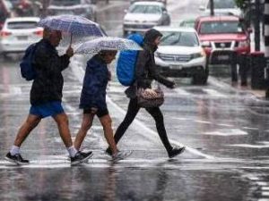
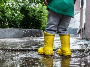 Originally Published July 21, 2020 by Linda Lou Burton posting about Wellington, New Zealand from Little Rock, Arkansas – Light rain in Wellington today, with a high of 52. I don’t mind the rain. I learned how to enjoy a misty day living in Seattle, it doesn’t even slow you down. I’m settled in one time zone and one season for now; so I imagine Wellingtonians walking in the rain today, water drops splatting as their boots come down. Is there anything more fun than splashing in a puddle? It’s irresistible, especially when you’re wearing your rubber-ducky yellow. Wellies in Wellington, time for a story.
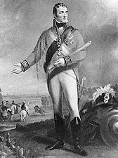
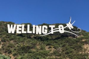
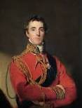 The city of Wellington, New Zealand was named in honor of Arthur Wellesley, the first Duke of Wellington; a title that comes from the town of Wellington in England. Now, the Duke was a popular fellow, having won the Battle of Waterloo in 1815, and when the original settlers of the New Zealand Company sat down in 1840 to name their new colony, the Duke’s name popped to the top. He was a supporter of the principles of “colonization.”
 But let’s go back to England for a moment. The Duke wasn’t just a war hero, he was also a bit of a fashion plate. Now “Hessian boots” were quite dandy-looking, high-cut and tasseled, but one day the Duke asked his shoemaker to modify the design a little, removing the trim, and cutting it to fit more closely around the leg. A good riding boot, but smart enough for evening wear, the style began to be called “the Wellington.” This soft leather boot became the main fashion for men of the British aristocracy through the mid 1800s.
Then along came Charles Goodyear, and vulcanization, and rubber boots. And a bit of re-branding. A “wellington-type” boot made of rubber was the perfect choice for farmers! Or anybody who had to work outdoors in the muck and the mire.
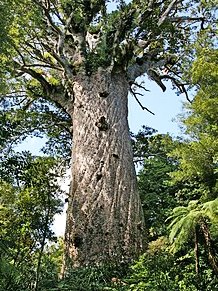 Now for one more twist. The Kauri tree grows in New Zealand, a tree that oozes a resin from its bark and cones. This resin, or gum, builds up in the forks of the tree, drops to the ground, and over time as the tree falls and dies the littered wood and gum eventually get buried by soil or drowned in swamps. The Māori – the indigenous Polynesian people of New Zealand – had many uses for this gum. They chewed it fresh from the trees; they used it to start fires and make torches.
Enter the Europeans, who saw the commercial benefits of Kauri gum. In the early 1840s a consignment was sent to London to make fire-kindlers and marine glue. But its real value was as an ingredient in varnish, and an industry was born. Māori and European settlers began digging the stuff out of the ground. Swampy, muddy ground. Boots were a good thing to keep your feet dry, natch?
Wellies! Gum Boots!
 The farming town of Talihape in the North Island claims the title “Gumboot Capital of the World” and has annual competitions and events. Most gumboots are black, though certain professions call for white, but kids, of course, wear boots of many colors. Like rubber-ducky yellow.
Next rainy day when you pull out your Wellies, aka Gumboots, remember the Duke, the Māori, and Charles Goodyear. What an incredible round-the-world connection.
History is a fascinating thing.
» posted on Sunday, July 17th, 2022 by Linda Lou Burton
Topsy Turvy
 Originally Published July 20, 2020 by Linda Lou Burton posting about Wellington, New Zealand from Little Rock, Arkansas – I don’t know how the jet-setters do it. Crossing the International Dateline east to west on my now defunct RTW Capital City Quest, I’d lose an entire day. Crossing the Equator, I’d change hemispheres, and therefore, seasons. It may feel like 106 in Little Rock today, but it’s winter in Wellington! Though winter there isn’t too bad – 54 degrees with a breeze today; 100% chance of rain.
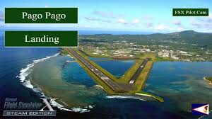
Pago Pago, American Samoa is the southernmost US capital city, but Wellington, New Zealand is the southernmost capital city in the entire world. It is also the most remote capital city, the farthest from any other capital. Now that’s a noteworthy distinction, and puts it at the top of my “Capital City Superlatives” list.
 Here are some basics about Wellington: its urban land area is 171 sq miles, the metro area 536, with an elevation of 0 at the waterfront and 1,624 in the hills. It isn’t New Zealand’s largest city, population-wise, Auckland is. Wellington’s urban population is 215,400, with a metro population of 424,200. That’s comparable to the US capital cities of Little Rock, say, or Madison, Wisconsin. The population breakdown shows about 72% of Wellingtonians are of European ethnicity; 15% Asian, 14% Maori, 10% various Pacific peoples, and the remainder Middle Eastern, Latin, African, and other.
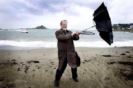 Wellington has been capital of New Zealand since 1865, and sits at the south end of the north island, between Cook Strait and the Remutaka Range. Because of its location in the Roaring Forties – strong westerly winds caused by air being displaced from the Equator towards the South Pole – it is considered the world’s windiest city, giving it the nickname Windy Welly.
It has a few other catchy names too – in 2016 the Mercer Quality of Living Survey ranked Wellington 12th Most Livable City in the World; in 2018 Deutsche Bank ranked it first in the world for both livability and non-pollution (those winds help, I suppose!). And Lonely Planet dubbed it the Coolest Little Capital in the World, pretty snazzy, I’d say.
But why am I talking? Those who promote New Zealand for a living have the best websites I’ve ever seen, so let’s read up, no mask needed for that. Straight from the horse’s mouth, https://www.newzealand.com/us/wellington/ will guide you not only in Wellington, but over all of New Zealand, with focus on any city of your choice; https://www.wellingtonnz.com/ tells everything you’ll want to know about the capital city with gorgeous pictures and fast-paced videos.
Here are a few things I shamelessly lifted from their sites, hoping to promote the area, and wishing I were there.
Things To Do in Wellington
Surrounded by nature and fueled by creative energy, Wellington is a compact city with a powerful mix of culture, history, nature and cuisine. Fuel your visit with strong coffee and world-class craft beer – Wellingtonians are masters of casual dining, with plenty of great restaurants, night markets and food trucks.
 Relax at Oriental Bay, Wellington’s golden-sand inner-city beach and delve into the many museums, art galleries and theatre shows that make up the city’s pulsing cultural scene. If you’re into the outdoors, Wellington has action-packed adventure activities like mountain biking and sea-water kayaking, as well as beautiful walks around the harbour and surrounding hills. Ride the cable car up the hill to Kelburn for amazing views over the city. On the waterfront itself you’ll find New Zealand’s national museum, Te Papa, meaning ‘our place,’ one of the best interactive museums in the world.
Or if you just want a quickie two-minute tour, watch this video!
https://www.youtube.com/watch?v=72stLrXYmHo
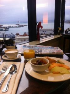 As for me and my make-believe COVID-19-free RTW journey, I got up at 7 AM on Saturday July 18, flew from Pago Pago to Apia to Auckland to Wellington in a sleepless mad rush of plane changes and time changes and weather changes and culture changes, and arrived at my hotel at 9 AM Wellington time on Monday July 20. In true jet-setter style, I’m booked in an executive suite at the Intercontinental, 14th floor, waterfront view, where I hunker down, gaze across the bay, and try to figure out which end is up.
Tomorrow I’ll be right side up again.
» posted on Saturday, July 16th, 2022 by Linda Lou Burton
Time Flies
Originally Published July 19, 2020 by Linda Lou Burton posting about American Samoa from Little Rock, Arkansas – I was so terrified I’d miss the flight I called Talofa Airlines. I was booked with Air New Zealand to fly from Apia, Samoa to Auckland, then Wellington, for my stay in the southernmost capital city in the world. The WORLD! Air New Zealand would depart Apia at 9:45 PM on the 19th and fly me through the night; my Wellington hotel was booked beginning Monday, July 20.
That part was easy. But first, I had to get to Apia.
 Lots of inter-island flights via Talofa, no problem there. But I kept staring at the map and that International Dateline that separates Pago Pago and Apia. I simply could not wrap my mind around the concept of TIME.
“When do I need to leave Pago Pago to get to Apia in time to catch my July 19th flight?” I asked. “Do I need to check out of Sadie’s-By-The-Sea on the 18th or the 19th?”
She assured me that I must check out on the 18th. “So, I LEAVE Pago Pago on Saturday the 18th, fly west to Apia, and ARRIVE 30 minutes later on Sunday the 19th?” I repeated this phrase several times. “Are you SURE?”
She was sure.
Thanks to COVID-19, I will not get to experience how it feels to lose an entire day of one’s life while being perfectly behaved. So instead, on this hot Sunday afternoon in Little Rock (it is 96 feels like 106 at 1 PM) I will concentrate on “How I Would Spend My Time” on the beautiful, still virus-free, island of American Samoa, if I were really there, whatever day it was.
I’d focus on the two reasons I came: to see the National Park, and to experience the “capital city” aspects of our southernmost US capital. With a room right on the water at Sadie’s-By-The-Sea, I’d be feeling rested, and ready to go.
The National Park Visitor Center is just a mile from Sadie’s, the road follows the harbor; I’d have a rental car. I’d learn about the subsistence farming that is allowed on some parklands, it’s the Fa’a Samoa way; there are small plantations to see. I’d learn about the birds, as the park is 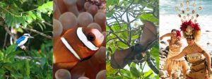 home to over 35 resident and migratory species – seabirds, water birds, forest birds, shorebirds; perhaps I’d spot a blue kingfisher (you know how I love birds!). I’d learn about the Pe’a (Fruit Bats), with wing spans up to 3-feet wide. These unusual bats are active both day and night and they only live here; also called the Flying Fox, one is featured on the 2020 American Samoa quarter! I’d learn about coral reefs, marine life, rainforests; things I don’t know much about and seldom get a chance to see. I’d learn about the customs and the history; the villages, the chiefs, the princesses. The celebrations, and the dance. That’s just the Park. https://www.nps.gov/npsa/index.htm
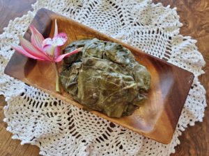 Then I’d follow the map to find my way around town. Maybe I’d lunch at the famous Sadie Thompson Inn; or check out the Marketplace in Fagatogo Square, looking for traditional Samoan food like palusami (wrapped bundles of taro leaves with a coconut and onion filling, sometimes with chicken, fish, or corned beef).
 I’d stop at the Maota Fono complex, a bee-hive shaped building based on the traditional Samoan fale (oval or circular, domed, thatched roof held up by poles). The American Samoa territorial legislature (Fono) is housed here; there is a two-story main wing, with offices for the legislators and governor, flanked by two single-story wings housing the legislative chambers. The Fono is a bicameral legislature with a House of Representatives and a Senate, the only legislature in the US that is both bicameral and nonpartisan. (The Nebraska Legislature is nonpartisan but is a unicameral body.)
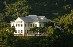 I’d stop at Government House, a colonial mansion atop Mauga o Ali’i (the chief’s hill). The building was erected in 1903 under orders of a US Naval Admiral; from here naval governors administered the territory until 1951. It now serves as the official residence of the territory’s governor and first lady, where they host major dignitaries who visit the island. There are five public rooms, one showcasing Samoan artifacts.
I’d stop at the Jean P Hayden Museum; in addition to Samoan artifacts, it has Moon Rocks due to American Samoa’s link to the Apollo Moon Missions. I’d stop at the Ocean Center at the National Marine Sanctuary, where one of the main exhibits is a room-sized global system displaying planetary data. https://americansamoa.noaa.gov/visit/
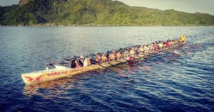 I’d drive out to Blunt’s Point to see the World War II Cannons, and stop at Utulei Beach and gaze across Pago Pago Harbor to Rainmaker Mountain on the other side. I’d do my best to wangle a ride in a fautasi, a long boat with 40 paddlers, and I’d shop for a puletasi – that’s a two-piece long fitted blouse and skirt.
I’d talk with everyone who’d talk with me, making sure I always said SAH-mo-a when speaking, as it is pronounced there, and not Sa-MO-a, as I’ve always done.
Seems like I’d need to add a day, not lose one. Time flies.
 Governor: Lolo Matalasi Moliga
Proclamation issued July 1, 2020 in effect until July 30, 2020 regarding COVID-19 restrictions lists current status as Code Blue: minimal social disruption with emphasis on social distancing, hygiene, and cough etiquette.
Office of the Governor: https://www.americansamoa.gov/office-of-the-governor