» posted on Tuesday, November 5th, 2013 by Linda Lou Burton
The Corn Is Dead
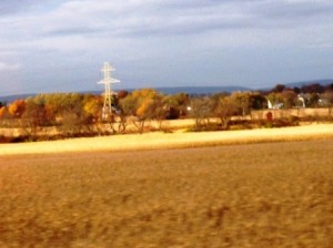 Linda Burton posting from Harrisburg, Pennsylvania – Remember the Iowa cornfields early this summer? “Knee-high by the 4th of July” was the saying; lush green as far as the eye could see. That time is past now; it’s November, and the only cornfield I spotted on today’s drive in Pennsylvania stretched across the valley as pure gold; rustling cornstalks waiting to be mulched, in that final farming phase of the season. I didn’t see many crop fields on the New England part of the Journey; the focus there is foliage, and oh yes, maple syrup and apple trees. I welcomed the open space of the
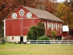
  cornfields as I approached Harrisburg and passed into Pennsylvania Dutch country, where I spotted a few barns sporting Hex signs. These cheerful folk-art designs generally feature birds, or flowers, or hearts. I bought a small Hex sign when we passed through the area in the 60’s, back when my kids were small; it has hung in every house I’ve lived in since. Maybe I’ll get another one while I’m here; a sign to remember the Journey by. Signs. I’m scanning through today’s photos now; other than the cornfield, there
  really are no pretty landscape scenes; most are pictures of signs I saw today. Signs! It was a long, wearying drive; daylight to dark from Hartford, Connecticut to Harrisburg, Pennsylvania; complete with four major traffic jams. In order to avoid the congestion of New York City I stayed north on I-84 to the western edge of Connecticut, and on across New York state. I didn’t get a picture of the funniest sign I saw (and probably the newest) – “It Can Wait. Text Stop Ahead.” Sure enough, there are “Text Stops” along the freeways now. Signs. “Construction Ahead” was the most prolific, of course. May I show you more?
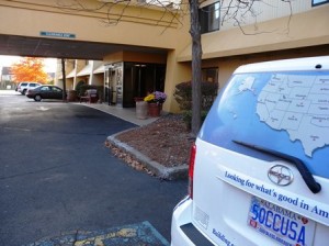 The first sign of the day – “Looking for what’s good” – was on the back of the Scion; a picture taken as I loaded the car this morning. It reminded me of the purpose of the Journey. Looking for what’s good. The most pleasant and welcoming sign was on the front of the patriotic New England-red Village
 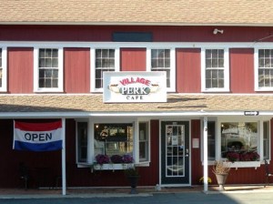 Perk Café in Sandy Hook, where I stopped in a last-ditch effort to find postcards from Connecticut. OPEN was the message. “What is that delicious smell?” I asked as I went in the door. “Onions,” was the reply. They didn’t have postcards, but they did have three kinds of quiche. “I’ll take the one with
 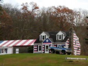 mushrooms and onions,” I said. “Year Round Yard Sale” was the sign posted in front of what I named The Patriotic House; that was much later, all the way into Pennsylvania, at the edge of the Delaware Water Gap National Recreation Area, somewhere between Dingmans Falls and Bushkill Falls. There was no sale going on in the yard however; just a pickup truck sitting alone.
The part of the drive in the Recreation Area was my only respite from freeways, trucks, and traffic jams. It was 40 miles of peace and quiet; I’d crossed the Delaware River as I entered 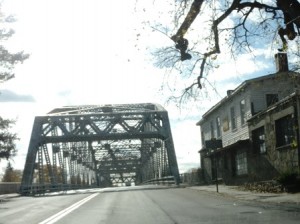 Pennsylvania from New York at Port Jervis, where three states meet. There was no sign welcoming me to the state; but I noted the change in automobile license plates; when I stopped for gas in Matamoras I asked, to verify. “This is Pennsylvania,” said the lady-in-charge, “and that is New Jersey right across the river. See the monument on the hill?” Looking on the map tonight, I see that the highest point in New Jersey is there; elevation 1,806 feet. The Appalachian Trail is there too; it follows the Delaware on the New Jersey side all the way into Pennsylvania near Stroudsburg, on Kittatinny Mountain. I’d crossed the Trail in New York, just before I got to the Hudson River; I’d almost cross it again at Roadside America, where it runs just a few miles north of I-78; it goes over the Susquehanna River north of Harrisburg.
 Did you know that Nazareth and Bethlehem, Pennsylvania are only a few miles apart, on either side of I-78? Did you know that Washington’s Headquarters State Historic Site is on the
  Hudson River in New York just a few miles south of I-84? And that West Point Military Academy is just a few more miles south of that? The Appalachian Mountains, the Hudson River Valley, the Delaware Gap – these interesting and
 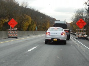 beautiful parts of the Journey went by today in a flash; only now, studying the map, can I begin to appreciate where I traveled today. Too much traffic;
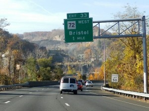
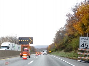
 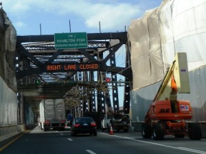 too many trucks; too many signs. Construction Ahead. Speed Limit 45. Be Prepared To Stop. Road Use Restricted. State Liability Limited. Right Lane Closed. Exit 33 leads to Bristol. Choose New York or Albany? Choose Philadelphia or Quakertown?
 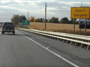 Don’t Tailgate! And then, the sign I’d been waiting for, Harrisburg 19 Miles. The sun was at the horizon by then; the GPS switched from daylight to nighttime mode; the background went dark.
Sitting in my room in Harrisburg tonight, I realize the end of the Journey is getting close; Harrisburg is the 47th capital city. The rest of the cities are relatively small; Harrisburg has a population of 49,528 (US Census 2010), making it the 39th most populous capital; Charleston, West Virginia and Olympia, Washington are similar in size. The Susquehanna River is only a few miles away from where I sit; Philadelphia is 100 miles to the east; Pittsburgh 200 miles to the west. Within 15 miles are two areas that are familiar, for very different reasons – Hershey (think chocolate); and Three Mile Island (think nuclear).
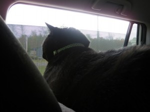 “We’ve seen a lot of countryside,” I said to the cats, as I came across a photo of Jack looking out the car window from the top of his carrier during a McDonald’s break. He was sniffing the air of a place he’d never been before. And he was enjoying it. That’s something, isn’t it? The corn is dead, Daylight Saving Time has ended, and the Journey is almost over. “I have to be careful not to let the distractions get in the way,” I reminded myself. “I don’t want to miss a minute.”
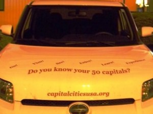 And then I got to the picture of the last sign of the day, lettered across the hood of the Scion; taken as I finished the unload. Do you know your 50 capitals?
Well, almost.
