» posted on Monday, March 25th, 2013 by Linda Lou Burton
Getting To The Bottom
 Linda Burton posting from Charleston, West Virginia – History or habit? How do you correctly say “Kanawha,” the name of the river that runs through Charleston? The surest sign somebody doesn’t know much about your town is when they mispronounce a local landmark. I didn’t want to be rude; I called the Visitors Bureau and asked. “How do you pronounce the name of your river?” (Ka-NA-wah? KAN-a-wah?) “However you want,” was the reply. “I call it Ka-NAW but other people say different.” Intense discussion followed, including a poll of the staff. Ka-NAW? What happened to the “H”? Why two syllables instead of three? What is the origin of the name? The staff unanimously agreed on “Ka-NAW” as the preferred term, and told me it was originally an Indian name – Ka-na-wa-ha. Or something like that. One thing was settled for me; I’m going to call it Ka-NAW, as is the habit of current residents. Next I wanted to get to the bottom of the history of the name. I talked to the reference desk at the downtown library; I consulted the West Virginia Encyclopedia online; I read Wikipedia. Wikipedia had this to say, with a list of impressive references: Ka(ih)nawha” derives from the region’s Iroquoian dialects meaning “water way” or “canoe way” implying the metaphor “transport
 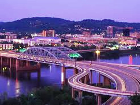 way,” in the local language. The Glottal consonant of the “ih” dropped out as few European settlers and homesteaders were fluent with any of the dialects of Iroquois. Bill Wintz, a descendant of Kanawha Valley pioneers and the West Virginia Historical Society’s 1994 Historian of the Year, wrote in the West Virginia Encyclopedia that “the river was variously called the Conoy, Conoise, Cohnawa, and finally the Kanawha.” TMI; I decided to turn my attention instead to basic facts.
According to the USGS gauges located on the river at Charleston, the Kanawha River was 19 feet deep there yesterday, with a discharge rate of 1.25 feet per second; go to their site to check for current conditions. http://waterdata.usgs.gov/usa/nwis/uv?site_no=03198000 Now that’s a fact!
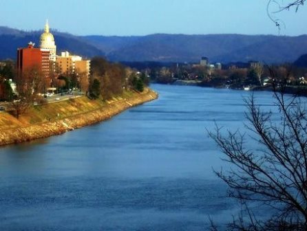
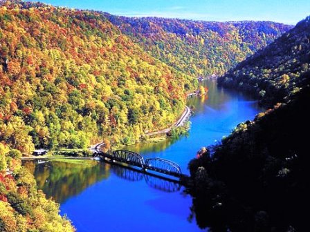 Here are a few more basics. For starters, it is the principal river in West Virginia. It begins where the New River and the Gauley River meet, in rugged mountain territory. The New River Gorge is a designated National River; I remember crossing it on I-64 before I got to Beckley; it’s coming from the Appalachians in Virginia. The Gauley River is part of a National Recreation Area in Fayette County to the north; the rivers meet near the Gauley Bridge at Hawks Nest State Park and the Kanawha is born. From there it flows 97 miles in a northwesterly direction to the Ohio River, through Charleston of course; I first spotted it on my right as I approached the city. It must have been like “heaven” to early settlers; a pathway through harsh terrain, and as some said, a route to the rest of the world. From the Ohio, to the Mississippi, to the Gulf of Mexico! Tributaries bringing more water into the Kanawha are the Coal, the Pocatalico, and right in Charleston, the Elk.
Archeological artifacts provide evidence of the earliest indigenous people in the valley; of prehistoric cultures and then of Native American nations who lived in the river valley and fought over its resources, resisting the European Americans who began arriving during the colonial years. Because the river level fluctuated wildly, first settlers were unable to use it for transportation until the 1840’s, when boulders and snags were removed. As far back as 1826 consideration was given as to the practicality of uniting the Kanawha River with the James 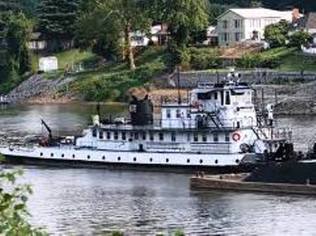 and Roanoke rivers by canals, railroads, or both; however local political considerations outweighed an overall plan; that didn’t happen. The construction of locks and dams began in 1875; the river is now navigable about 20 miles upstream from Charleston and river levels are carefully controlled.
You can read about the locks and dams on the Kanawha River at the US Army Corps of Engineers site and even pinpoint on a map which ships are coming and going at any given moment. http://www.lrh.usace.army.mil/Missions/Navigation.aspx. Yes, there are industries located along the river; the valley contains significant deposits of coal (you know about West Virginia coal), natural gas, and salt brine (more about that in later posts).
As for recreational purposes, although it suffered from industrial pollution in those days when everyone everywhere was dumping into rivers, thanks to the Clean Water Act of 1972, it is now safe. So, go fishing! The Kanawha River contains largemouth, smallmouth, spotted, 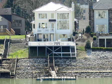 white and hybrid striped bass; flathead and channel catfish; walleye; sauger; muskellunge; several sunfish species; freshwater drum; carp; smallmouth buffalo; longnose gar; skipjack herring; sturgeon; paddlefish; shad and other small forage fish, just to name a few. Take time to enjoy a concert riverside at Haddad Park, or a picnic on Magic Island. Take a cruise on a sternwheeler. Or sit on your porch, if you’re lucky enough to have a porch facing the river, and watch the world go floating by, whether you call it the Ka-NA-wah or the Ka-NAW.
History may be in the eye of the teller, but habit is the reality of the moment.