» posted on Thursday, September 22nd, 2022 by Linda Lou Burton
Squiggles On The Map
Linda Lou Burton posting from Ngorongoro Conservation Area, Tanzania– This is about the NCA. Remember that map I bought at the Visitor Center? At the end of that overbooked day when Ben lectured so long we were two hours late getting to the Lodge? Well, truth be told, I didn’t retain much of what he said, but I have since been studying my $6 topographical map. So brace yourself to listen, here are some fascinating facts about “where I am.”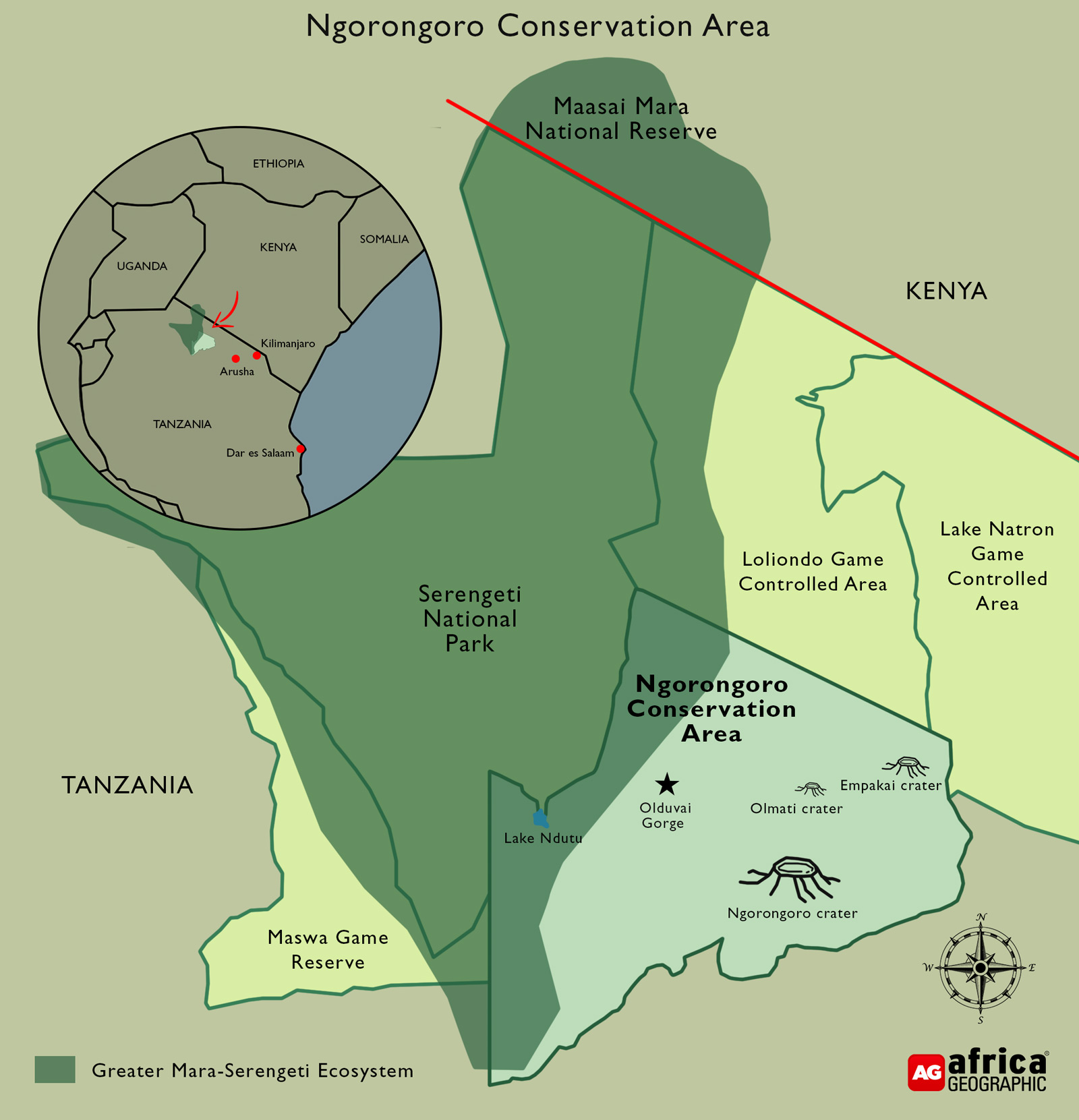
 The Ngorongoro Conservation Area (hereafter referred to as NCA) in northern Tanzania was established 63 years ago (1959). It is an extension of the Serengeti (where we’re headed today). Seasonally, up to 2.5 million antelope, zebra, buffalo and wildebeests move around these two areas. The NCA is a UNESCO Mixed World Heritage Site and an International Man and Biosphere Reserve, and is often referred to as the 8th Wonder of the World.
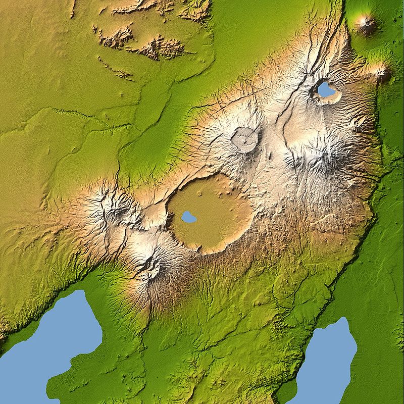
Size: NCA covers over 3,200 square miles of Africa’s wildlife, people, and archaeological sites. The heart of the NCA, the Ngorongoro Crater, with an area of 100 square miles and walls rising to a height of 2,000 feet, is the world’s largest intact volcanic caldera.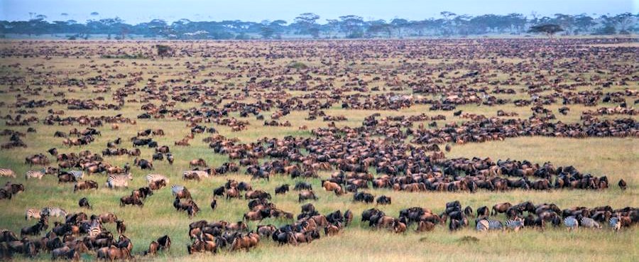
Wildlife: NCA, together with Serengeti National Park and other areas supporting the Serengeti ecosystem, supports the greatest concentration of wildlife on Earth. From June through October, the Serengeti Plains are dry, bare and dusty. From November through May, the rainy season, they turn lush green and millions of animals flood this rich pasture.
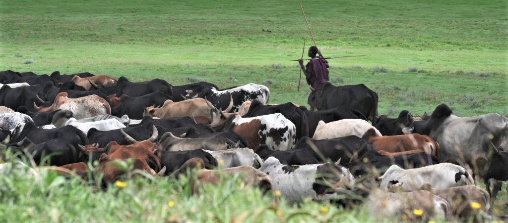 People: Over the past few thousand years, a succession of cattle-herding people colonized this area from the North. The Maasai arrived about 300 years ago from Ethiopia, coming down the Nile River. Today, approximately 64,000 Maasai pastoralists live in the area with their cattle, donkeys, goats and sheep.
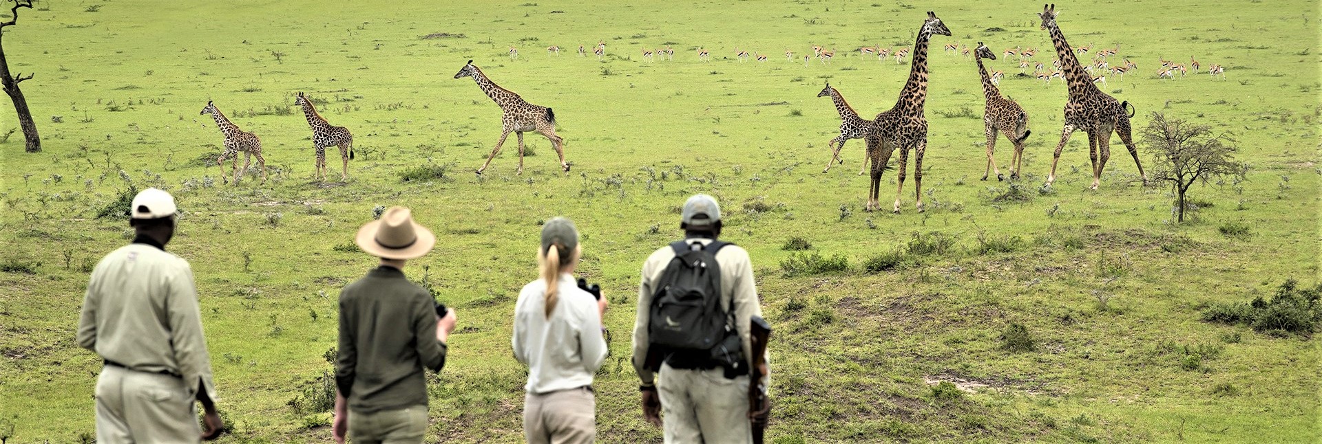 Activities in the Area: Walking, camping, and game viewing safaris. Cultural tourism experiences among Maasai and Hadzabe tribes. Visits to archaeological findings at Olduvai Gorge.
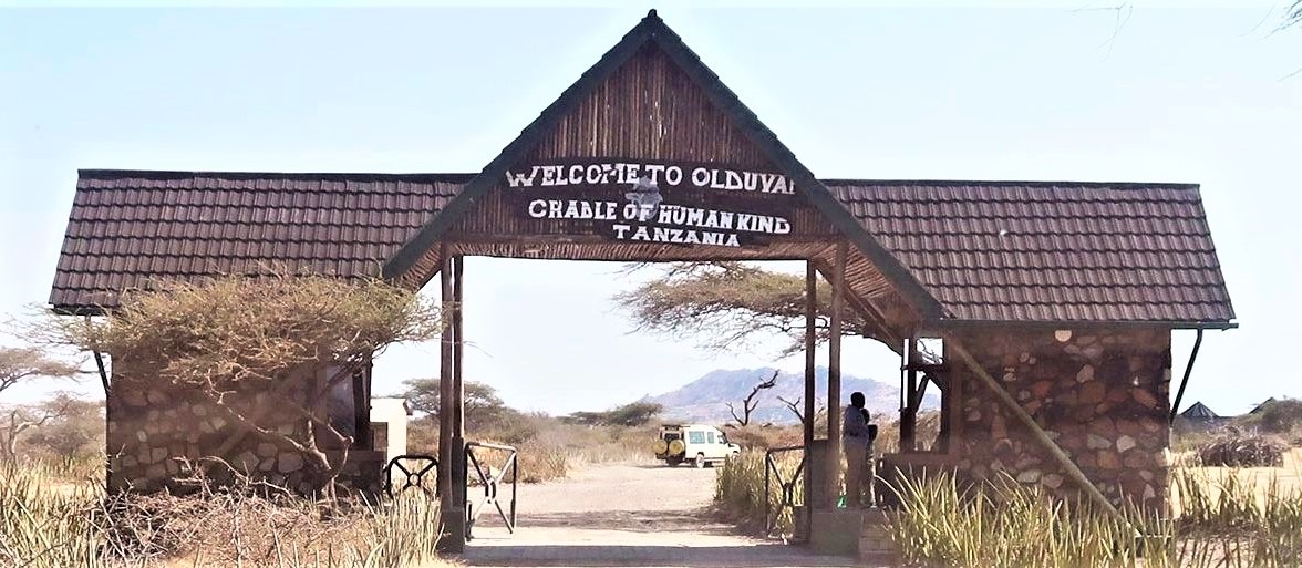 Olduvai Gorge (Oldupai = Maasai spelling) is the historic place where Mary and Louis Leakey unearthed a jawbone in 1959, which pushed back the beginning of human evolution well past the 1.5 million year mark. The different kinds of hominids found here show a gradual increase in brain size and in the complexity of their stone tools. The Oldupai Museum is open daily at the Gorge, where visitors can learn more details of this fascinating story.
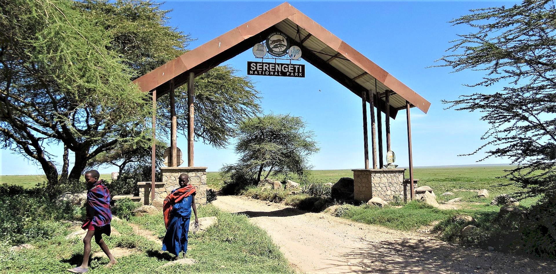 We pass through Olduvai Gorge on our way to Mbuzi Mawe Serena Tented Camp today, but with an 80+ -mile-drive on rutted dirt roads ahead, I’m guessing we won’t stop at the Museum. I’m listing interesting sites I see on the NCA map; you can check Google maps too. We have to travel along the Crater’s rim before beginning our descent; we’ll pass the Senato Gate which controls the Senato Descent Road into the Crater (Rick doesn’t remember if that’s the one they took). We’ll pass by Loonguku and Kiloko Cultural Bomas, all in the Oldupai Gorge; we’ll pass the road leading to Oldupai Museum, the Leakey Camp Research Station, Archeological Excavations, and Archeological Camp near Naiprosuet Hill. Then we enter the Serengeti Plain and Serengeti National Park. At the moment, all of this is just squiggles on a map. By tonight, they’ll be places I’ve been. Or at least, passed by.
Alphabetical Listing of More NCA Things To See
- Empakaai Crater: Tiny crater, 2 square miles, lake and forest, great views over the Rift Valley and the cone of Oldonyo Lengai.
- Lerai Forest: Small forest of yellow barked acacia trees on the Ngorongoro Crater floor.
- Nasera Rock: Huge monolith 328 feet high in the Goi Mountains.
- Oldonyo Lengai: Still active volcano; climb the steep slopes to see the steaming, bubbling activity.
- Olkarien Gorge: Narrow Gorge in the Goi Mountains; during the rains, Maasai bring cattle here to drink.
- Olmoti Crater: Shallow grassy crater and source of the Munge River which pours through a notch in a spectacular waterfall on the rim of the Ngorongoro Crater.
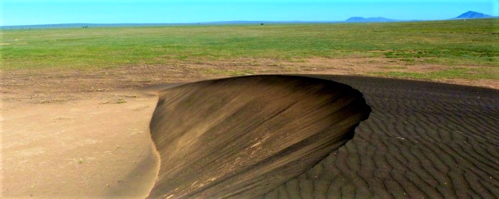
- Shifting Sands: A little black sand dune marches across the plains, covering 56 feet a year; blown by a strong, steady wind, it maintains its size and elegant shape.
Ngorongoro Conservation Area Authority https://www.ncaa.go.tz/
Mbuzi Mawe Serena Tented Camp https://www.serenahotels.com/mbuzi-mawe
Next Post: Famous Restrooms