» posted on Monday, May 7th, 2012 by Linda Lou Burton
Ring Around the Collar
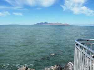 Linda Burton posting from Salt Lake City, Utah – A trip to Salt Lake City wouldn’t be complete without a trip to the Great Salt Lake. It is, after all, the largest lake between the Great Lakes and the Pacific Ocean, and the largest saltwater lake in the Western Hemisphere! It is about 75 miles long, about 35 miles wide, and about 30 feet deep at its deepest part; all those numbers vary depending on the weather of the year. It is landlocked, with rivers feeding in but nothing flowing out, resulting in a mineral-filled mix five times saltier than the ocean. About. Only brine shrimp, and brine flies, can survive in it. I wanted to get my feet wet there, and so I did. And I learned something new.
 I knew that Great Salt Lake is the remnant of Lake Bonneville, an ice-age lake. What I did not know is that in addition to the Great Salt Lake, Lake Bonneville left behind some very conspicuous reminders of “the way it was.” They are ancient terraces, or benches, etched into the landscape along the lake’s former shoreline! And they are very visible, when you know what to look for. The terraces were eroded by wave action and follow a contour line. Several levels of the old shorelines can be seen above Salt Lake City, along the Wasatch Front. The “Bonneville Bench” is approximately 5,100 feet in elevation, the highest level attained by Lake Bonneville some 15,000 years ago. The benches protrude from the mountainside, well above the valley floor.
 I won’t go into the geologic catastrophe that befell Lake Bonneville, that’s another story in itself; instead I’ll focus on how people use these ancient benches today. As a trail, of course – the Bonneville Shoreline Trail (BST)! Plans call for it to eventually stretch 280 miles from the Idaho border to Nephi, Utah; today about 100 miles are officially designated as part of the BST. It’s all a work in progress, of course, started by citizens who love to hike, and love the out of doors.
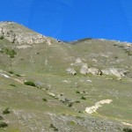 A route around a lakeshore may sound like a gentle path, but the Bonneville Shoreline is not. In the thousands of years since the lake evaporated, rivers and streams running from the mountains have cut canyons and ravines across the once even shore. The trail continuously descends into and climbs out of these obstacles along its route. The Wasatch fault is still active, pushing the peaks of the Wasatch Range higher. Escarped ridge faces border much of the trail.
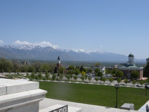 Want to see it? If you’re in the city, just look up at the nearest hill. You may spot a jogger in a bright red jacket on the Trail at about 5,100 feet, no swimsuit in hand for this shoreline trek. And just think, if you are standing on the front steps of the state capitol building, you’d be underwater, 15,000 years ago.
Learn more about the Bonneville Shoreline Trail, volunteer to help, or make a donation http://www.bonnevilleshorelinetrail.org/index.htm
Get directions to specific segments of the BST, such as the Red Butte Creek Road Trailhead, or the Emigration Canyon Trailhead; see photos too http://www.bonnevilleshorelinetrail.org/saltlaketoparleys/saltlaketoparleys.html
Recreational activities and historical facts about the Great Salt Lake http://www.utah.com/stateparks/great_salt_lake.htm
