Archive for July, 2022
» posted on Sunday, July 31st, 2022 by Linda Lou Burton
Looking For Ocean
 Originally Published July 30, 2020 by Linda Lou Burton posting about Perth, Australia from Little Rock, Arkansas – I told you it was a big country. If you want to imagine Australia-size against United States-size, my Canberra-Perth flight today (on my NDI RTW) is similar to traveling from Washington DC to Los Angeles via Atlanta, as I have a layover in Melbourne again. It looks like four hours, when you think of local times, but I’m crossing several times zones, so I resolve the issue by just not thinking about how long it takes. Even though it’s winter and gets dark in Perth about 5:30 PM, I’ll be happily settled at my hotel by then. In time for a beach walk right outside my door. And a toe wiggle in the Indian Ocean. It won’t be warm. Nor will it be cold. When it comes to latitude, Perth is similar to New Orleans, or north Florida.
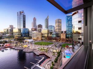 Perth is a city of about 2.14 million sun-loving people, named after a city in Scotland, and capital of Western Australia. Like California, a rush to the area happened due to the discovery of gold in the late 19th century; during WWII it was a base for submarines operating in the Pacific; after the war there was a surge of immigrants. More mining booms in recent years; Western Australia produces more than 50 different minerals from about 1,000 operating mines; the Super Pit Gold Mine is the largest in terms of scale. Perth is regional headquarters for several large mining operations. And of course as capital of an Australian state, the state’s Parliament and Supreme Court are here, along with Government House, the Governor’s residence.
One of the most interesting facts about Perth is that it is one of the most isolated major cities in the world! It is closer to Jakarta, Indonesia, 1,900 miles away, than it is to Sydney, 2,100 miles to the east. And if you head straight west, you’ll cross 5,400 miles of Indian Ocean before you reach South Africa.
 I mentioned earlier than Western Australia makes up a third of the entire country of Australia; it has 8,000 miles of coastline touching two oceans; it has a chunk of desert land too. The Great Victoria covers 134,650 sq miles in WA and SA; the Tanami covers 71,200 sq miles in WA and NT. The Great Sandy (103,900 sq miles), the Gibson (60,000 sq miles), and the Little Sandy (43,100 sq miles) are completely within WA. If you want to compare again, the US Mojave Desert covers 47,877 sq miles. So lots of water in Western Australia, and lots of not.
This part of Australia is an ancient land. There’s been virtually no mountain-building since the rifting from Antarctica, so most of the state is low plateau, except for the Darling Scarp running north to south east of the coastal plain and Perth. Averaging about 1,900 feet in elevation, it is a mild-mannered mountain range, except, it doesn’t seem to like airplanes. Especially in the summertime, strong easterly winds present serious issues for planes using the Perth Airport. Wind shear! Let’s hope my winter landing is calm.
That’s about all I can tell you about Perth right now; tomorrow I’ll play tourist and talk about the fun stuff.
And that Indian Ocean, one more Bucket List item, done and checked.
» posted on Saturday, July 30th, 2022 by Linda Lou Burton
City in a Landscape
 Originally Published July 29, 2020 by Linda Lou Burton posting about Canberra, Australia from Little Rock, Arkansas – My last post was about a beautiful building; this one focuses on the beautiful city in which that building sits, Canberra, Australia. It takes a lot of thinking, planning, and arguing for “what is best” when building a city. Washington, DC is a good example of that, beginning with George Washington’s appointment of Pierre Charles L’Enfant to design a capital city, and what happened over the years after that. Here is Canberra’s story of Charles Scrivener, Walter Burley Griffin, Marion Mahoney Griffin, and Charles Weston, and what happened over the years.
About Charles Scrivener
 Charles Scrivener was the New South Wales Government Surveyor back in 1908 when the Canberra area was chosen by Parliament as a site for Australia’s future capital city. The Canberra valley, set in an amphitheatre of hills, was chosen because it had “a bracing climate, good water supply, and natural beauty.” Scrivener’s task was to explore the area and prepare a contour survey, which he did; he also suggested four possible points along the Molonglo River where dams could be constructed to create ornamental waters. Fast forward to 1964. Scrivener Dam was inaugurated, creating Lake Burley Griffin, an ornamental body of water in the center of Canberra.
About Walter Burley Griffin and Marion Mahoney Griffin
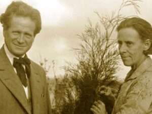 Walter Griffin was born in Chicago, studied architecture at the University of Illinois, and for a time worked with Frank Lloyd Wright. He eventually set up his own practice and from 1899 to 1914, created more than 130 designs for buildings, urban plans and landscapes in Illinois, Iowa, Michigan and Wisconsin. In 1911 he married Marion Mahony, an MIT graduate in architecture. They were on their honeymoon when they heard of the international competition held by the Australian Commonwealth Government to produce a design for its new capital city. They worked feverishly to prepare their entry; Marion presented Walter’s designs in a series of vivid drawings showing a city nestled into hills and valleys. In May 1912 their design was selected as the winner out of 137 entries.
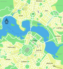 Walter’s winning design showed a chain of lakes along the Molonglo Valley and a triangular framework for a central national area laid out along major vistas. Marion’s drawings showed a new type of Australian town plan, where buildings, roads and gardens could work together to make a picturesque and livable city. The geometric pattern, developed from the topography of the land, had long tree-lined avenues and boulevards and incorporated significant areas of natural vegetation.
Griffin was appointed Federal Capital Director of Design and Construction in 1913, and moved to Australia to supervise the detailed planning of his modern city. But lack of money, the intervention of the First World War, and bureaucratic obstacles made it difficult to realize his plan. Many of his main avenues and parks were laid out at that time, but due to differences with the administration and his own uncompromising vision, Griffin left Canberra at the end of 1920 to work elsewhere in Australia.
In 1924 the government gazetted the Griffins plan for Canberra so that no changes could be made without the approval of Parliament. This protection ensured that the plan for the city remained essentially as Griffin intended it to be — a logical expression of the site. The strength of Griffin’s design is its adaptability to grow and change.
Griffin was largely under-appreciated during his time in Australia, but recognition of his work has steadily grown. In 1964, when Canberra’s central lake was filled by the construction of Scrivener Dam, it was named Lake Burley Griffinr.
About Charles Weston
Charles Weston was an English-born horticulturist who pioneered the greening of the area and its surrounding hills. European settlement after the 1820s had a significant impact on the site; of principal concern was the destruction of tree cover on the hills and the consequent degradation of the shallow soils; there was widespread water and wind erosion. Weston faced a challenging task; an added problem was the conflict between Griffin and Weston over choices of suitable tree species. In all, between 1913 and 1926, Weston was responsible for the planting of two million trees and shrubs.
When Weston arrived in 1913, he assessed the suitability of a wide range of exotic and indigenous trees and shrubs for the site and devised the best methods of planting. He established an arboretum to test the growth of trees; by 1920 almost 45,000 trees had been planted there; it is still in use today. He next turned his attention to rehabilitating degraded hill areas. Between 1915 and 1924 he treated over 2,500 acres of public land. He took the first steps in the conservation of the ACT’s rural landscape. He laid down a set of conditions to achieve control over the lopping of vegetation for fodder and the killing of trees by ring-barking. In addition, he issued free trees to landholders.
 He created a special landscape character for the streets, avenues and parklands of the emerging city, achieving strong seasonal color effects and protection from the bitter cold and hot dusty winds.
The legacy of Charles Scrivener, Walter Burley Griffin and Marion Mahoney Griffin, and Charles Weston is the creation of Canberra as a city in the landscape.
As of June 2019 the population of this city in a landscape named Canberra was 426,704. Located 93 miles inland from the coast near the Brindabella Ranges, it covers an area of 314 square miles at an elevation of approximately 1,900 feet; the highest point is Mount Majura at 2,913 feet.
It’s a really pretty place, you should visit.
 Visit Canberra https://visitcanberra.com.au/
» posted on Friday, July 29th, 2022 by Linda Lou Burton
Nothing Like It
Originally Published July 29, 2020 by Linda Lou Burton posting about Canberra, Australia from Little Rock, Arkansas – I’m a sucker for capitol buildings – on the Journey Across America I always dug into the story of how each state’s capitol came to be; the reasons for the choices made in design, location, and symbols. So natch, the story of Australia’s Parliament House was the first thing I wanted to dig into when I woke up in Canberra this morning (on my NDI RTW). Here’s the story straight from the Australian Government website. https://www.aph.gov.au/
Canberra Has Had Two Parliament Houses
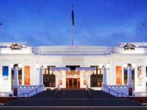 Old Parliament House started life in a rather temporary status. It was named the Provisional Parliament House when government moved from Melbourne to the new capital of Canberra in 1927, designed to serve the needs of Parliament for a maximum of 50 years. It was built in a “Stripped” Classical style common to the 20s and 30s in Australia – no columns or pediments, but the symmetry associated with neoclassical architecture.
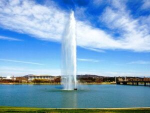
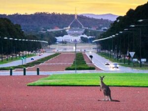
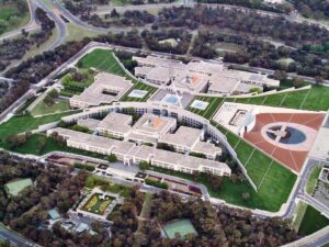
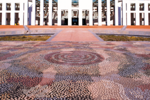
By the 1970s the building had exceeded its capacity and was in need of considerable repair and renovation, so plans for a new Parliament House began. The new building was opened by Queen Elizabeth II in May 1988. I don’t know what the Queen thought about it, but it’s safe to say there is nothing like it anywhere else in the Commonwealth, or for that matter, the world. Its roof is covered in grass, and the shape is, well – two boomerangs. No kidding, look at the aerial view. See the curves? And that flagpole on top is 266 feet high, weighs 275 tons, and flies a flag that is 42 x 21 feet, about half the size of a tennis court. To the right is the forefront and verandah of the building, where the public is welcomed in; a 640 sq foot mosaic by an Aboriginal artist depicts ancient western desert dreaming.
 But the Old Parliament House wasn’t left out; some of the facades of the New included deliberate imitation of some patterns of the Old, so that there is a slight resemblance despite the massive difference of scale. And the Old still stands today; at the base of Capital Hill at the centre of the Parliamentary Triangle, which is the heart of Walter Burley Griffin’s design for the city of Canberra. (More about the city’s design in the next post.)
Here are some numbers to stretch your mind with regard to the scope of the New Parliament House project.
- 320 entries were submitted in the international design competition from which Architects Mitchell/Giurgola & Thorp were chosen
- 7 years were involved in the construction of the new Parliament House
- 10,000 workers were involved in building and fitting out the building
- 300,000 cubic metres of concrete went into the construction of the building
- $1.1 billion AUD was the cost of the new Parliament House
- 79 acres are covered by Parliament House and its landscape setting on Capital Hill
- 4,500 rooms are in Parliament House
- 5,000+ people work in the building when Parliament sits
- 1 million people visit Parliament House annually
- 200 years is how long Parliament House is designed to last
I can only say – it’s worth a trip to Australia just to see this building!
A few words directly from the Parliament House site about the Chambers:
Parliament House is the heart of Australian parliamentary democracy, and one of the most open parliamentary buildings in the world. It was designed to encourage public access and involvement while responding to the Australian climate, landscape, vegetation, and even the quality of the light.
The House of Representatives has 151 members and is the house in which government is formed. The colour scheme of the House Chambers reflects the green associated with British Parliament’s House of Commons and the eucalypt green of the Australian landscape.
The Senate, or upper house, has 76 senators: 12 from each state and two each from the Northern Territory and the Australian Capital Territory. The Senate Chambers reflect the red of British Parliament’s House of Lords and the shades of ochre red in the Australian landscape.
The Members’ Hall lies at the centre of Parliament House and is not open to the public. Inlaid on the first floor is a bronze Federation Star, representing each of the states and mainland territories of Australia; flowing water comes into the Reflective Pool.
https://www.aph.gov.au/Visit_Parliament/Things_to_Do/Take_in_some_history
https://www.aph.gov.au/Visit_Parliament/Things_to_Do/Discover_the_architecture
Parliament House Entry
» posted on Thursday, July 28th, 2022 by Linda Lou Burton
Home Away From Home
Originally Published July 28, 2020 by Linda Lou Burton posting about Canberra, Australia from Little Rock, Arkansas – How about a picture-book post today, as the Now-Defunct-Imaginary ‘Round The World continues? For someone who doesn’t like to fly, I seem to be spending a lot of time in the air, or waiting to get into the air. First there was Little Rock- Seattle-Maui-Hawaii. Then Honolulu-Pago Pago-Apia-Wellington, quite a trick to plan with that dateline crossing. But getting everywhere I wanted to go in Australia took even more fine-tuned planning. The River Murray Tour was only available on Fridays, so, I had to be in Adelaide on a Friday; for the government buildings in Canberra I needed a weekday; there was simply no way to start on one side of the country and go in a straight line!
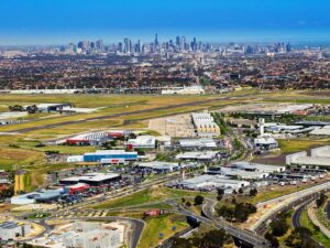
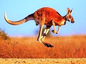
![]() So from Wellington, it’s Melbourne to Adelaide to Alice Springs to Ayers Rock to Melbourne to Canberra; Northwest and West and North and West and South and Northeast. And there are two more inter-continent flights at the end of the week! Australia is all Qantas, with its cute kangaroo logo, quite appropriate for hopping around the continent.
So from Wellington, it’s Melbourne to Adelaide to Alice Springs to Ayers Rock to Melbourne to Canberra; Northwest and West and North and West and South and Northeast. And there are two more inter-continent flights at the end of the week! Australia is all Qantas, with its cute kangaroo logo, quite appropriate for hopping around the continent.
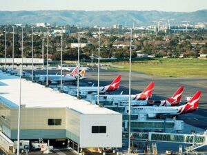
- Melbourne Airport MEL: Australia’s 2nd busiest; 35 million passengers annual; elevation 434 ft; runways 11,998 ft & 7,500 ft
- Adelaide Airport ADL: Australia’s 5th busiest; 8.5 million passengers annual; elevation 20 ft; runways 10,771 ft & 5,420 ft
- Alice Springs Airport ASP: Australia’s 18th busiest; 640,000+ passengers annual; elevation 1,789 ft; runways 7,999 ft & 3,717 ft
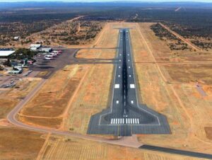
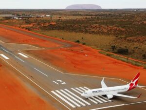
- Ayers Rock Airport AYQ: 309,000+ passengers annual; elevation 1,626 ft; runway 8,527 ft
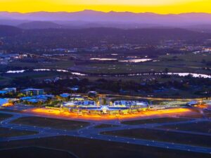
- Canberra Airport CAN: 3 million + passengers annual; elevation 1,886 ft; runways 10,771 ft & 5,509 ft
Melbourne Airport
Adelaide Airport
Alice Springs Airport
Ayers Rock Airport
Canberra Airport
In order to appease my non-flying psyche, I pacified myself with nice places to sleep, and recover, in between. So here’s my list, look and learn. Need help planning YOUR next trip?
I chose all my hotels based on location and looks. Were they handy to what I wanted to do, and did their “look” fit in with the unique aspects of their location? And in case I was TIRED after all that flying and just wanted to stay put at my hotel, I wanted a view I’d enjoy, and pleasant dining. I may not be a tourist, but I wanted to enjoy every minute of my trip, and that included where I slept, and ate, and collected my thoughts between all those Qantas jaunts.
- Adelaide Hilton, 233 Victoria Square
- Alice Springs Hilton, 82 Barrett Drive
- Ayers Rock Desert Gardens, Ayers Rock Resort
- Hotel Canberra Hyatt, Commonwealth Avenue
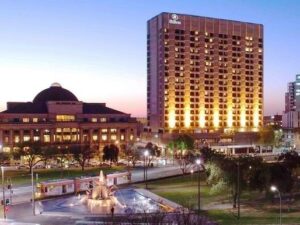
Adelaide Hilton
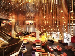
Adelaide Hilton Lobby

Alice Springs Hilton
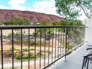
Alice Springs Hilton Balcony
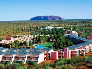
Desert Gardens Resort
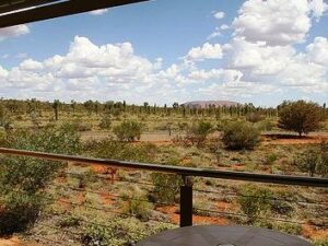
Desert Gardens Balcony
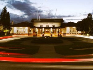 Canberra Hyatt tonight, an after-dark arrival, dinner and a good nights sleep. Tomorrow: All about Australia’s Capital City!
Note: All these hotels met my requirements perfectly, and I am sad I had to cancel ALL these reservations due to COVID-19. Don’t worry guys, I’ll be there some day.
» posted on Wednesday, July 27th, 2022 by Linda Lou Burton
A Little Culture
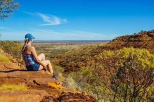
Originally Published July 27, 2020 by Linda Lou Burton posting about Uluru, Australia from Little Rock, Arkansas – I established yesterday that it is a major faux pas to climb Uluru. But climbing has been banned only since October 2019, 146 years after William Gosse spotted it and dubbed it Ayers Rock. And 55 years after a chain was planted up its side to help the white ants, as tourists were sometimes referred to by natives, claim victory at the top. The controversy over the use, value, and meaning of the giant monolith is not unlike the controversy in the United States regarding Mount Rushmore. “Meaning” comes from cultural perceptions.
 Looking out my window at Uluru, glowing in the morning sun, I see a rock, a really gorgeous piece of nature’s handiwork, a tick off my Bucket List of Natural Wonders of the World. Because I am a respectful person in general, I will honor all restrictions and requests during my visit, and do no harm. I didn’t steal a pebble in Antarctica, or take a sneak photo of Guernica in Madrid.
But what does Uluru mean to a culture different from mine, in this case, the Pitjantjatjara Aborigines; specifically the local Anangu? I started with a Park Fact Sheet, and an explanation of Tjukurpa (pronounced ‘chook-orr-pa’), the foundation of Anangu culture. I learned that, like religions elsewhere in the world, Tjukurpa provides answers to many important questions.
- Tjukurpa is the religious philosophy that links Anangu to the environment and our ancestors. Tjukurpa is the traditional law that tells us how to care for one another and the land that supports us. It tells of the relationships between people, plants, animals and the physical features of the land.
- Tjukurpa stories tell about the beginning of time when ancestral beings first created the world. They tell us where important places are, how to travel from one place to another, and where and when we can find water and food. They contain important lessons about the land and how to survive in the desert as well as rules for appropriate behaviour.
- Tjukurpa is not written down. It is memorised and passed on to the right people like an inheritance. This law was given to us by our grandfathers and grandmothers, our fathers and mothers, to hold onto in our heads and in our hearts.
The Tjukurpa fact sheet https://parksaustralia.gov.au/uluru/discover/culture/tjukurpa/
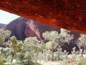
 Uluru holds great spiritual significance as a place where many creation stories converge. It is a meeting place with many pathways and tracks leading to and from it. Each path tells an important story that teaches a vital lesson. Walks follow the tracks of the ancestral beings. The rock’s shapes and textures hold knowledge and stories that have been passed down through generations and are still relevant today.
Mala Walk The Mala people are the Anangu’s ancestors, and their story is one of the most important of Tjukurpa. This walk includes the caves where they camped when they first arrived at Uluru; the kitchen cave where they prepared their meals. Rock art to see along this walk.
Mutitjulu Waterhole Mutitjulu Waterhole is a place to listen quietly to the sounds of the beginning of time. The presence of water means this area is particularly lush and shady. Wallabies wander the tall grasses and river red gum trees. Bush foods abound, tjantu (bush tomatoes), ili (figs) and arnguli (bush plums).
 Kuniya Walk The Kuniya walk is the site of one of Uluru’s most dramatic creation stories – the deadly battle between Kuniya (the woma python woman) and Liru (the poisonous brown snake man). Here, understand how creation stories are played out on the surface of Uluru today. Kuniya and her spirit are here, and the caves she protects are still used by Anangu.
Liru Walk The Liru walk (named after the poisonous brown snake) winds through a mulga forest and connects the Cultural Centre with the base of Uluru; a fantastic place to soak up the solitude, listen to the wind in the trees and contemplate the sheer magnitude of Uluru.
Lungkata Walk Tjukurpa teaches not to steal from others through the story of Lungkata (the cheeky blue-tongue lizard man). Panpalala birds sing, ancestral birds that play a part in the Lungkata creation story. With binoculars or a long lens see hundreds of tiny birds nesting high up in the caves.
Northeast Face Walk The northeast face of Uluru is dotted with sacred sites. According to Anangu culture, the rock formations here hold chapters of creation stories that should only be learned in person. It is inappropriate for any images of these sites to be viewed elsewhere. For these reasons, Anangu request that you enjoy the scenery of the northeast face but do not take any photographs. By following this request, you are ensuring the continuation of Anangu cultural beliefs and the protection of their spirituality.
Put away the camera, be in the moment and experience the calm, peaceful environment that surrounds you. When you return from the park, tell your friends that they have to visit for themselves, because there are some parts of Uluru that you can only see in person.
And so I deliver that message to you today.
Tomorrow I head for Canberra, the national capital. And I’ll tell you more about AIATSIS, the Australian Institute of Aboriginal and Torres Strait Islander Studies, a government agency focusing on the history and culture of Aboriginal Australia.
» posted on Tuesday, July 26th, 2022 by Linda Lou Burton
The Big Red Rock
Originally Published July 26, 2020 by Linda Lou Burton posting about Uluru, Australia from Little Rock, Arkansas – Australian English defines a “walkabout” as a journey (originally on foot) that is made by an Australian Aboriginal in order to live in 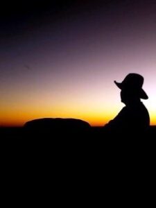 the traditional manner. It’s also been defined as a spiritual or ceremonial journey, a rite of passage, a chance to be alone, or the opposite, to wander among people. My NDI RTW is a “walkabout” of sorts, a pause in routine to wander, observe the world, and to think. Like my Journey Across America – two years on the road, just me and the cats, paying attention, learning. I am not a tourist.
What will I learn in my two-night stay near Uluru? I’m booked at the Ayers Rock Resort Sunday and Monday nights, and that puts me into the tourist category I suppose, so I’ll talk about “the naming” issue first; a story of what was, what happened, and what is going on today at the Big Red Rock that means “Australia” all over the world.
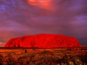
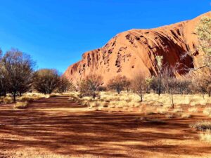
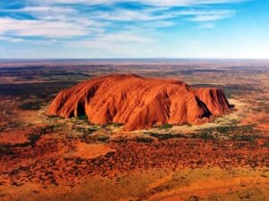 The Big Red Rock is sandstone, 2,831 feet of it; 1,142 feet are above ground. It has a perimeter of 5.8 miles. It appears to change color at different times of the day; it glows red at dawn, and sunset. There are a number of springs, waterholes, and rock caves in the area, which is 208 miles southwest of Alice Springs. It is a UNESCO World Heritage Site and a major tourist attraction. And it is controversial.
Archaeological finds indicate that humans have inhabited the area for more than 10,000 years, but Europeans didn’t arrive until the 1870s. William Gosse, one of the first British explorers in the area, named the Big Red Rock Ayers’ Rock, in honor of the Chief Secretary of South Australia, Sir Henry Ayers. But the people already living there called the Big Red Rock Uluru. It was a sacred place, a part of their creation story.
In a sequence of events much like America’s history, further European exploration followed; resources were documented as land for farming or mining; fences were erected and claims made. The British concept of fences and property boundaries was unknown to Australia’s native population, who lived a more nomadic life, following resources as nature provided. Due to the new restrictions and effects of grazing and drought, bush food stores soon were depleted; competition for resources created conflict. Interaction between natives and white settlers became frequent, and sometimes violent.
Between 1918 and 1921, large adjoining areas of South Australia, Western Australia, and the Northern Territory were declared Aboriginal reserves. The Petermann Reserve included Uluru, or Ayers Rock. In 1940, the Petermann Reserve was made smaller, to allow people to look for gold; in 1958 it was made smaller again when the government created the Ayers Rock-Mt Olga National Park.
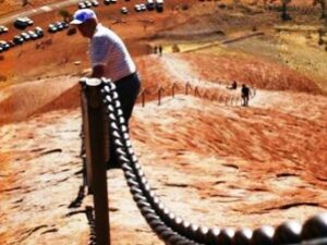 Bill Harney was the first Park Ranger; by 1959, the first motel leases had been granted and an airstrip constructed close to the northern side of Ayers Rock. In 1963, a chain was added to assist tourists in climbing the rock. The development of tourism produced adverse environmental impacts; in the early 1970s all accommodation-related tourist facilities were moved outside the Park. A 40-sq mile area nine miles from Ayers Rock was developed with tourist facilities and an airport; it became known as Yulara. In 1992, the Northern Territory government sold its majority interest in the Yulara resort and it was renamed Ayers Rock Resort. And that is where I’m staying, in a “room with a view,” that allows me to sleep, and wake, with the Big
 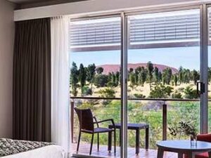 Red Rock watching over me.
Who “owns” the rock today, I wondered. Digging deeper, I learned that in 1985 the Australian government returned “ownership of Uluru” to the Pitjantjatjara Aborigines, with the condition that the local Aṉangu would lease it back to the National Parks and Wildlife agency for 99 years and that it would be jointly managed.
The agreement that the “climb to the top” by tourists would be stopped was not kept. The local Aṉangu do not climb Uluru because of its great spiritual significance. They request that visitors do not climb the rock, partly because the path crosses a sacred traditional Dreamtime track, and also out of a sense of responsibility for visitors safety. Yet until October 2019, the Park Visitors Guide said “the climb is not prohibited, but we prefer that, as a guest on Aṉangu land, you will choose to respect our law and culture by not climbing.”
According to a 2010 publication, just over one-third of all visitors to the Park climbed Uluru; a high percentage of these were children. It is a steep hike, and often quite windy. There have been at least 37 deaths since such recreational climbing deaths were recorded. Several controversial incidents on top of Uluru including a striptease, golfing, and nudity, led to renewed calls for banning the climb. In November 2017, the Uluṟu–Kata Tjuṯa National Park board voted unanimously to prohibit climbing Uluru. There was a surge in climbers and visitors after the ban was announced! But the ban went into effect October 26, 2019, and the climbing chain was removed.
 There are many other trails and walks available in the Uluṟu–Kata Tjuṯa National Park, where close to half a million visitors come every year. Tomorrow I’ll go walkabout, respectfully, at the Big Red Rock called Uluru; the Base Walk that goes around the rock’s circumference. I’ll listen to the stories. I’ll wake up early enough to see the sun rise, and watch the red sunset glow.
And I will dream.
Walks To Read About
https://parksaustralia.gov.au/uluru/do/walks/
https://parksaustralia.gov.au/uluru/pub/visitor-guide.pdf
.
» posted on Monday, July 25th, 2022 by Linda Lou Burton
Alice’s Wonderland
Originally Published July 25, 2020 by Linda Lou Burton posting about Alice Springs, Australia from Little Rock, Arkansas – I won a spelling bee in 5th grade with the word “aborigine.” I didn’t know the meaning, so Miss 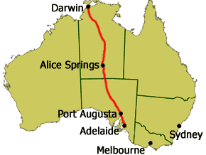 Hudson had me look it up. That’s when I decided I’d visit Australia. So I am going to Alice Springs, and I am going to Uluru. I catch a Qantas ride this morning (on my NDI RTW); two hours to cover the 952 miles from Adelaide to the very center of the continent. I’m booked tonight at the AS Hilton with a view of the MacDonnell Mountain Range just out my window. The plan: get there in time for lunch. Winter is the best time to visit the Red Center; mornings and evenings are cool; days are sunny and warm.
The Tourism Australia website tells me this is what I will find.
- A true Aussie outback town in the heart of Australia’s Red Centre
- A sweeping horizon, burnt red dirt, and rugged mountain ranges
- A deeply spiritual and passionate Aboriginal community
- A stunning arts scene and fun and quirky festivals
- A sanctuary for orphaned kangaroos
https://www.australia.com/en-us/places/alice-springs-and-surrounds.html
A True Aussie Town & How It Grew
 Alice Springs is Australia’s geographic center, right between Adelaide and Darwin. The Red Center is an arid environment – annual rainfall 11 inches – consisting of several deserts. It’s known as Mparntwe to its original inhabitants, the Arrernte, who have lived in the Central Australian desert for tens of thousands of years.
European exploration began when John Stuart led an expedition through Central Australia in the early 1860s. Ten years later a white settlement was started with the construction of a repeater station on the Australian Overland Telegraph Line (OTL), which linked Adelaide to Darwin and Great Britain. This opened the interior for permanent settlement. The Alice Springs Telegraph Station was built near a waterhole and named Alice Springs after the wife of the Superintendent of Telegraphs, Charles Todd. It was after gold was discovered in 1887 that significant European settlement occurred; it was 1929 when the train line to Alice was built that the town’s European population began to grow. Aboriginal Centralians outnumbered 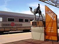 European Centralians until the mid-1930s.
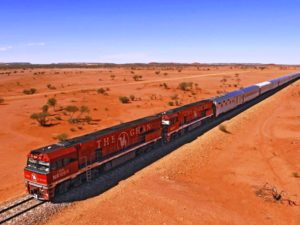
Camel trains were the original British-Australian transportation in the outback; operated by immigrants from then-British India (present-day Pakistan). Cameleers moved to Alice Springs in 1929 when the railway reached the town; they transported goods from the rail head to settlements to the north. The 1,849-mile Adelaide–Darwin railway was completed in 2004 when the Alice Springs-Darwin line opened. It is used by The Ghan passenger train and freight trains operated by One Rail Australia.
Who Lives There Now
 About 26,534 people live in the Alice Springs Urban Area. Aboriginal and Torres Strait Islander people made up 18% of the population. Aboriginal residents live in the suburbs, on special purpose leases or town camps, or further out at Amoonguna to the south and on small family outstation communities on Aboriginal lands in surrounding areas.
Americans have lived in Alice Springs since the establishment of the US Air Force Detachment 421 in 1954, as part of a joint American–Australian project called the Joint Geological and Geographical Research Station. Currently 2,000 residents of the Alice Springs district hold American citizenship. Several small immigrant communities have found a home in Alice Springs, including Vietnamese, Chinese, Thai, Sudanese and Indian ethnic groups.
Alice Springs has a large itinerant population composed of foreign and Australian tourists, Aboriginal Australians visiting from nearby communities, and Australian or international workers on short-term contracts working in stations, mines, healthcare and law enforcement.
The Terrain
 Arrernte country is rich with mountain ranges, waterholes, and gorges. The region consists of dry scrubby grassland and the MacDonnell Ranges which contain a number of hiking trails and swimming holes. The 139-mile Larapinta Trail follows the West MacDonnell Ranges and is considered among the world’s great walking experiences. The Simpson Desert southeast of Alice Springs is one of Australia’s great wilderness areas containing giant red sand dunes and interesting rock formations.
The Modern Town
The modern town of Alice Springs has European and Aboriginal influences. The Todd Mall hosts a number of Aboriginal art galleries. Alice Springs has many historic buildings, including the Overland Telegraph Station and Adelaide House, a beautiful stone building that was Central Australia’s first hospital; now a museum, it was built in 1926 by John Flynn, founder of the world’s first flying doctor service. A dispatch centre for the Royal Flying Doctor Service of Australia operates here. https://www.rfdsalicesprings.com.au/
The town is an important tourist hub and service center with several large hotels, a convention center, and a range of attractions, restaurants, and tour services. Alice Springs has nineteen public and private schools; School of the Air delivers education to students in remote areas.
The Stunning Arts Scene & Quirky Festivals
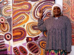 Alice Springs has a big reputation for Aboriginal art. Many diverse art galleries showcase one of the oldest living traditions in the world; contemporary art works tell traditional stories; superb dot paintings and watercolours by some of Australia’s most successful and prominent Aboriginal artists, including Barbara Weir, Minnie Pwerle and Albert Namatjira. A range of galleries line Todd Mall; the Araluen Arts Center is the hub of the visual arts scene. Read about the collections, the work done there, the public art, and the sacred sites, such as the hills that represent the dreaming of the Two Sisters, and the sacred 300-year-old corkwood tree. https://araluenartscentre.nt.gov.au/your-visit
Two quirky festivals of note: the Camel Cup and the Henley-On-Todd Regatta. Yes, July’s Camel Cup is just that, a day of really fun camel racing. And the Henley-On-Todd Regatta is a “boat” race in the dry sandy bed of the Todd River. It is the only “dry” regatta in the world, and yes, back in 1993 it was “called on account of rain.”
Orphaned Kangaroos
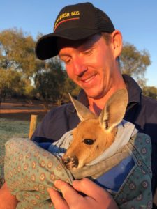 A Kangaroo Sanctuary with guided sunset tours through a 188-acre wildlife reserve; meet and feed rescued baby and adult kangaroos. Animals Come First is the motto; founder Brolga Barns says “Our mission is to educate and encourage people to rescue and care for kangaroos and other wildlife.” Kangaroo Dundee, a BBC/Nat Geo Series, is filmed here; shown in over 90 countries and now in its third series. Donations welcome. https://kangaroosanctuary.com/
I’m glad I was in that spelling bee, back in 5th grade. You never know how far a single word can take you.
» posted on Sunday, July 24th, 2022 by Linda Lou Burton
All About Adelaide
Originally Published July 25, 2020 by Linda Lou Burton posting about Adelaide, Australia from Little Rock, Arkansas – It’s hard to leave Adelaide. I would have scheduled a much longer stay for the RTW, but, when you have only a week to visit an entire continent the size of the US, you have to keep moving. And the mysterious Outback calls.
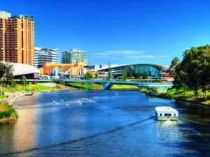 But before I leave, let’s talk about Adelaide, the capital city of the state of South Australia. It’s not only a great place to visit, it’s an even better place to live. It consistently ranks in the Top 10 of “World’s Most Livable Cities” as surveyed by the Economist Intelligence Unit, which measures a city’s Stability, Infrastructure, Education, Environment & Culture, and Healthcare (both quality and availability). Melbourne and Sydney also ranked in the Top 10, you can’t go wrong in Australia!
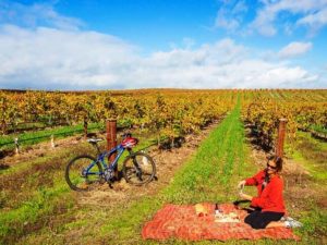
Pristine beaches and world-class vineyards don’t hurt a city’s livability quotient, nor does a moderate climate with hot dry summers and mild cool winters. South Australia has two nicknames – The Wine State and The Festival State – and I promised to tell you which I found to be most true. The answer: both are well-deserved!
South Australia’s Wine
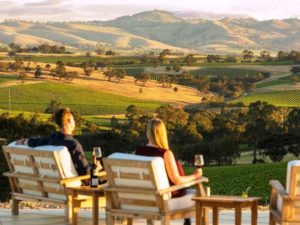 Adelaide is not only South Australia’s capital city, it is the wine capital of Australia – and one of the nine Great Wine Capitals of the World, alongside Bordeaux in France, Napa Valley in the US and Bilbao Rioja in Spain. There are 18 wine regions in South Australia, here is just a sampling:
- Barossa. Over 80 cellar doors, along with five-star retreats. Due to its Mediterranean climate Cabernets and Shiraz’ are unbeatable.
- McLaren Vale. Over 70 cellar doors only 40 minutes from Adelaide, close to stunning coastal vistas. World-class Shiraz, Grenache, Cabernet Sauvignon, Chardonnay.
- Clare Valley. Over 40 cellar doors just a scenic 90 minute drive from Adelaide; the Riesling and Rattler Trail cycle path winds through the countryside.
- Coonawarra. The Coonawarra is Australia’s top producer of premium red wines. Its wineries also sell some of the best local produce available.
- Adelaide Hills. 60 wineries just minutes from Adelaide and one of Australia’s best cool-climate wine regions.
The University of Adelaide’s National Wine Centre is the showcase for the Australian wine industry. It provides important links with the wine industry, is an important platform for wine education and research, and provides a world class venue for food and wine. A visit there shows the winemaking process from vine to bottle; the Wined Bar offers over 120 wines for tasting. Nestled in the city’s Botanic Gardens. https://nationalwinecentre.com.au/
South Australia’s Festivals
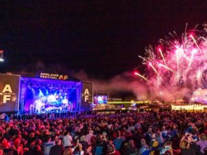 Go back to 1960, when the Adelaide Festival of Arts was established with backing of the city and city businesses. Then along came the Adelaide Fringe – an unofficial series of performances and exhibits. In 1970 construction of the Adelaide Festival Center began; add the South Australian Film Corporation in 1972, the State Opera of South Australia in 1976. It all kept growing.
The Adelaide Festival expanded to include Adelaide Writers’ Week and WOMADelaide, an open-air festival in Botanic Park celebrating the World of Music, Arts & Dance. Then came the Adelaide Cabaret Festival, the Adelaide Festival of Ideas, the Adelaide Film Festival, FEAST, Tasting Australia (food and wine, yum). Ever heard of MAD MARCH? Combine the Festival, the Fringe, WOMADelaide, Writers’ Week and the Adelaide 500 street motor racing event, along with evening music concerts all happening at the same time, and you have earned a sure-enough festival reputation.
There are also many international cultural fairs in Adelaide, such as the German Schützenfest and Greek Glendi. The Adelaide Christmas Pageant includes the southern hemisphere’s largest Christmas parade. Yes, Santa shows up in a beard and the floats are decorated with snowmen, though it is warm-weather time there.
There are too many live music and theatre venues to count; Lonely Planet labeled Adelaide “Australia’s live music city,” and Adelaide was recognized as a “City of Music” by the UNESCO Creative Cities Network.
- Next Adelaide Festival 26 Feb – 14 Mar 2021 https://www.adelaidefestival.com.au/
- WOMADelaid https://www.womadelaide.com.au/
- Adelaide November Christmas Pageant https://www.christmaspageant.com.au/
So what do you think? Is South Australia The Wine State, or The Festival State?
As for the capital city of Adelaide, I haven’t yet mentioned EDUCATION (an educational hub, it’s known as a Learning City, three Nobel laureates completed education at St Peter’s College and the University of Adelaide), or SPORTS (home of two Australian Football League teams and one A-League soccer team).
But you should know this HISTORY of Adelaide, population today 1,345,777.
- Named for Queen Adelaide
- Founded in 1836 as the planned capital for the only freely settled British province in Australia
 Located close to the River Torrens in the area originally inhabited by the Kaurna people and known as Tarndanyangga, place of the red kangaroo
- Designed by William Light in a grid layout, interspaced by wide boulevards and large public squares, and entirely surrounded by parklands
The new city attracted immigrants from many parts of Europe; German Lutherans in 1838 brought vine cuttings with them that were used to found the wineries of the Barossa Valley; other Europeans escaping religious persecution were attracted to a city founded on religious tolerance; it’s known today as a City of Churches. St Francis Xavier’s Cathedral was consecrated in 1858; the Central Adelaide Mosque, built to accommodate the spiritual needs of Afghan cameleers, is Australia’s oldest permanent mosque.
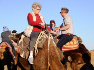
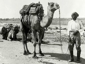 Which leads to one last historical tidbit, as I prepare to head north to the “red center” of Australia. The Afghan community in Australia became established in the 1860s when camels and their handlers were used to open up settlement in the continent’s arid interior. Until the advent of railways and motor vehicles, camels played an invaluable economic and social role in transporting heavy loads of goods to and from isolated settlements and mines.
Now you know why the passenger train between Adelaide and Darwin came to be named The Ghan, a story I’ll tell more about tomorrow, from Alice Springs.
» posted on Saturday, July 23rd, 2022 by Linda Lou Burton
River Murray & The Adelaide Hills
Originally Published July 24, 2020 by Linda Lou Burton posting about Adelaide, Australia from Little Rock, Arkansas – Wellington to Melbourne to Adelaide in six hours yesterday, no worries, mate. A good night’s sleep at the Adelaide Hilton, downtown on Victoria Square. The NDI RTW continues (Now Defunct Imaginary ‘Round The World) this morning when the tour bus picks me up out front.
 Adelaide Sightseeing it is. I am booked for a full-day River Murray Highlights Tour because, well because I love rivers. And the River Murray is on my Bucket List. I aim to cruise the longest river on every continent, and the Mississippi is the only one I can count, so far. I’ve even been through Lock #1 at St Paul! https://capitalcitiesusa.org/?p=11157/ There is no cruisable river in Antarctica, of course. But later trips will get me to South America’s Amazon, Asia’s Yangtze, and Europe’s Volga. Africa’s Nile is scheduled for this trip, but today, it is Australia’s River Murray.
The goal is not to cruise the full length of any of these rivers. It is just to be ON them for a while, to learn about them, and how they impact their part of the world. Rivers MOVE, they get somewhere. They DO something. They support life. We drink out of our rivers, and, yuck, we dump our wastewater into our rivers. Our rivers have the power to make electricity for us, and, where they are allowed, they deposit silts and nutrients on our soil to help things grow. They shift the land around, and change their course when they see a better route. And our rivers are built-in highways! Before roads, or trains, or planes, rivers moved people; today river commerce is an important part of our economy.
So how does the River Murray impact Australia? Here’s what the South Australia Department for Environment and Water tells us: https://www.environment.sa.gov.au/topics/river-murray
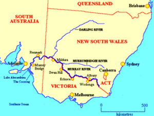
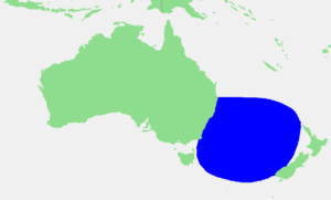
The River Murray, 1,558 miles long
 South Australians live in the driest state in the driest inhabited continent in the world. The River Murray is the life-blood of the state, providing essential water for irrigation, industry, domestic and recreational use and our precious wetlands and floodplains. In South Australia, in an average year, around 75 per cent of the water taken from the River Murray is used for primary production. This includes water for livestock, piggeries, dairies and wineries and for the irrigation of crops such as citrus, stone fruit, almonds, pasture, vegetables and other niche crops.
Other water uses include water supply for towns and metropolitan Adelaide, the environment and recreation. The river is also a popular place to visit and enjoy the beautiful locations, unique plants and wildlife, quality food and wine and outdoor activities.
The Murray-Darling Basin
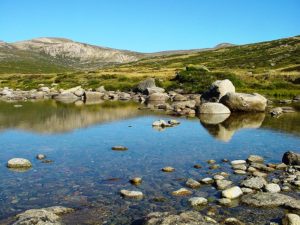 The River Murray headwaters are near Mt Kosciuszko, Australia’s highest point (7,310 ft), snow melt and rainfall drain down the western side of the Australian Alps, then the river meanders across Australia’s inland plains, forming the border between the states of New South Wales and Victoria as it flows to the northwest into South Australia. It is joined at Wentworth by the Darling River, then turns south at Morgan for its final 196 miles. The water of the Murray flows through several terminal lakes including Lake Alexandrina and The Coorong before emptying through the Murray Mouth into the Indian Ocean. The mouth is
 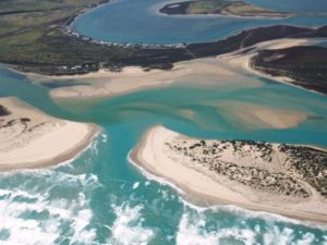 comparatively small and shallow, and dredging machines move sand from the channel to maintain a minimal flow from the sea and into the Coorong’s lagoon system. The lack of an estuary means that shipping cannot enter the Murray from the sea.
The Murray-Darling Basin includes the Australian Capital Territory, and parts of Queensland, New South Wales, Victoria and South Australia. The basin supports agriculture, tourism and other productive industries and is home to more than two million people. Outside the basin, a further 1.3 million people depend on its water resources, including Adelaide, the largest population base reliant on basin water resources. Drought, of course, is always a concern.
The Proud Mary
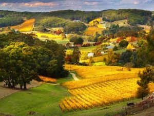 As for my Huck Finn river day, I’ll first see the river at Mypolonga, a settlement in South Australia on the bank of the lower Murray River; its name is from an Aboriginal name for Cliff Lookout. It’s about a 55-mile drive from my hotel in Adelaide, winding through the beautiful area known as the Adelaide Hills, famous for its cool-climate wine. The Proud Mary is our paddle-wheeler, Mississippi riverboat style; and a buffet lunch is part of the fun as we glide past stunning orange cliffs and weeping willows, watching for pelicans, cockatoos and cormorants; listening
  to commentary about the river’s history, and significance.
Abundant wildlife, spectacular scenery, beautiful skies and an overwhelming sense of tranquility.
Promised, and delivered. On the ride back to Adelaide, a stop at Melba’s Chocolate Factory, and Woodside Cheese Wrights at Woodside.
I am counting my blessings.
Adelaide Hills https://southaustralia.com/places-to-go/adelaide-hills
The Proud Mary, 2-day and 5-day cruises too. https://www.proudmary.com.au/
Melba’s Chocolate Factory https://www.melbaschocolates.com.au/factory/
Woodside Cheese Wrights, Kris Lloyd, Artisan https://krislloyd.com.au/
Special Note
Due to COVID-19, restrictions are in effect for travel in Australia. I offer a special note of THANKS to Adelaide Sightseeing for contacting me about the cancellation of my planned tour, and kindly refunding in full my payment for what would have been a delightful day, I’m sure. Very kind, great business practices.
Adelaide Sightseeing https://www.adelaidesightseeing.com.au/
» posted on Friday, July 22nd, 2022 by Linda Lou Burton
Crossing The Ditch
 Originally Published July 23, 2020 by Linda Lou Burton posting about Adelaide, Australia from Little Rock, Arkansas – The plan for Thursday, July 23. Sleep late. Morning walk. Lunch at the Intercontinental. Check out. Wellington Airport. Board a Qantas. (Always loved that name!) Fly to Adelaide, Australia. Let’s keep my now-defunct-due-to-COVID19-RTW in the present tense today, it helps with the imagining.
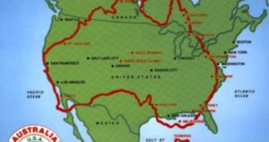
Leaving Wellington is hard to do. But then, I am heading for a major Bucket List Tick – my sixth continent! Born in North America, got to South America and Antarctica in 2005, made it to Europe and Africa in 2019. 2020 is the year for Australia and Asia, all SEVEN CONTINENTS finally under my belt. Or feet, more properly put. Walk on all seven continents. Check it off!
 But today, I have to cross the Tasman Sea. Folks in that part of the world call it “The Ditch.” It’s about 1,400 miles of water between New Zealand and Australia, and water being what water is, no fences define it, though geographers will tell you the Coral Sea and Pacific Ocean are to the north, the Cook Strait (that’s the water between New Zealand’s two main islands) to the east, the Southern Ocean to the south, and Bass Strait to the west – that’s the bit that separates Tasmania and the Australian mainland. Got that?
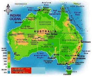
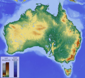
There is so much to tell you about Australia. It is the oldest, flattest, driest inhabited continent on earth! And it is both a continent, and a country. It has six states, and two territories. It is almost the size of the United States. I am googly-eyed to get there.
ACT – Australian Capital Territory. Area 910 square miles. People 427,419. Capital Canberra.
Like the United States, Australia has set aside a portion of itself to serve as the nation’s capital. The spot was voted on, chosen (though not without heated discussion, of course), and the capital city of Canberra was built from scratch. The ACT is in the southeast part of the country between the state capitals of Sydney and Melbourne, an enclave within the state of New South Wales. More about Canberra, of course I’ll visit there.
NSW –New South Wales. Area 309,130 square miles. People 8,128,984. Capital Sydney.
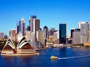 Everyone has seen the photo of the Opera House in the Sydney harbor, and it breaks my heart that I can’t fit Sydney within my RTW timeline. My parents raved about the city when they visited years ago, so I’ll have to let their footprints serve for me. Sydney is not only capital of New South Wales, it is also Australia’s most populous city. NSW edges Australia’s east coast, such a pretty state, with beaches, agricultural plains and highlands in the middle, and the Snowy Mountains to the west. Yes, they have skiing there. Nicknamed The First State, NWS was originally founded as a British penal colony. That was 1788. Just look at it now!
QLD – Queensland. Area 715,309 square miles. People 5,129,996. Capital Brisbane.
 Queensland is huge. I’m not kidding, only 15 COUNTRIES in the entire world are bigger than the state of Queensland in Australia (which is the 6th largest country). And Queensland is diverse. It has mountains. It has tropical rainforests. It has deserts. It has sandy beaches, and yes, Queensland is where you go for those world-famous Pacific waters coral reefs, if diving is your thing. Its nickname is The Sunshine State, its capital is Brisbane and sadly, I’m not visiting Queensland either. I do have a friend there though! I met Jennifer last year on my trip to Portugal-Spain-Morocco (yes, she rode the camel in the Sahara) and loved hearing her stories of farm living – flying off to boarding school as a child; koalas in her back yard when her kids were growing up. So, hi Jennifer! Thanks for sharing a taste of Queensland with me.
VIC – Victoria. Area 91,761 square miles. People 6,651,074. Capital Melbourne.
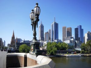 I am headed for Victoria as Melbourne is my first stop beyond the Tasman Sea. The state is small, but lots of people live in The Garden State (wheat, barley, pears, apples, asparagus, broccoli, carrots, potatoes, tomatoes in abundance). With the Australian Alps to the east and the Little Desert to the west, the OMG city of Melbourne sits midway, right on the harbor; Australia’s busiest seaport. Architecture ranges from 1800s Victorian to high-rise modern (52 skyscrapers!). It has the country’s most extensive network of freeways and the largest urban tram network in the world. Tullamarine Airport is where I’ll be changing planes often, wait and see how many times I stop here!
TAS – Tasmania. Area 26,410 square miles. People 537,012. Capital Hobart.
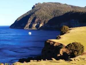 Tasmania is Australia’s smallest state, situated directly south of Victoria across the Bass Strait. There is a main island, with the capital city of Hobart in the southern part; but the state also includes 334 surrounding islands. Tasmania’s fascinating history of geology, peoples, settlements, and colonization make it a place I’d love to know more about and wish I had time to visit. It is generally Australia’s coolest spot, thanks to Southern Ocean breezes; maybe the reason for its nicknames – The Apple Isle and The Holiday Isle.
SA – South Australia. Area 402,903 square miles. People 1,759,184. Capital Adelaide.
 I’m spending two nights in Adelaide, South Australia’s capital city. Some of the driest parts of the country are in SA, but the Adelaide area has plenty of water. One is the nearby Murray River, one of my reasons for stopping here. South Australia seems to have two nicknames – The Festival State and The Wine State. I’ll let you know which I find most appropriate after my visit, either one sounds like a party!
WA – Western Australia. Area 1,021,478 square miles. People 2,639,080. Capital Perth.
 Queensland is huge, but Western Australia is REALLY huge. It makes up the entire western third of Australia! It touches two oceans – the Indian and the Southern. The Tropic of Capricorn runs across the middle of it. The Great Victoria Desert and The Great Sandy Desert sit on either side of that. If you stand at the edge of Kansas and look west to the Pacific, you’ll sort of get the idea of WA’s vastness. It seems to have two nicknames, The Wildflower State and The Golden State; that last one makes me think of California. I’ll tell you much more about WA when I visit the capital city of Perth, my last stop on my 6th continent.
NT – The Northern Territory. Area 548,640 square miles. People 244,761. Capital Darwin.
 I’m putting NT last on this list because it is officially a territory, and not a state. But I’ll be making two stops in this incredible, almost-other-worldly place I’ve been longing to see for years. My two stops are Alice Springs and Uluru – I’ll tell you all about them later. Sadly, Qantas connections just didn’t work timewise to get me to the capital city of Darwin, a grievous fact! And The Ghan, the train that runs between Adelaide and Darwin, runs just twice a week. Nickname for the NT — The Territory. Natch.
I’ve made a solemn promise – I’m not only going to reschedule my RTW when COVID-19 restrictions end and the world is safe for travel once again. I’m going back even after THAT, to stay at least a month in the Land Down Under.
And that’s my story, as I imagine myself flying across The Ditch.