‘Little Rock’ Category
» posted on Thursday, August 4th, 2022 by Linda Lou Burton
Good Things Come in Threes
 Originally Published August 3, 2020 by Linda Lou Burton posting about Bangkok, Thailand from Little Rock, Arkansas – “Bangkok is as intoxicating as it is diverse; a melting pot of exotic aromas, interesting sights and visual delights. It is a city with infinite layers to explore.” That’s the message on the Hotel.com website, which then presents a splendid list of Things To Do in Bangkok; the choices offered put me in mind of Twelve Days of Christmas, hum that tune as you read and you’ll see what I mean!
- 2 Days In All
- 6 Floating Markets
- 7 Things in Chinatown
- 9 Things in Old Town
- 10 Best Tours
- 11 Best Thai Restaurants
- 12 Night Markets
- 20 Must See Temples
- 21 Rooftop Bars
- 67 Best Things
I clicked on the 67 Best link (wondering how 67 things can all be Best and thinking it should be Great instead) and read about everything from the Grand Palace to a Crocodile Farm, making special note of 11 Best (Great? Top-Notch?) Thai Restaurants. My own hotel is one of the 21 Rooftop Bars so I’m set there. I decided that #1 of the 67 really is Best, here in the “hottest capital city in the world.” You know I’d pick the Palace first.
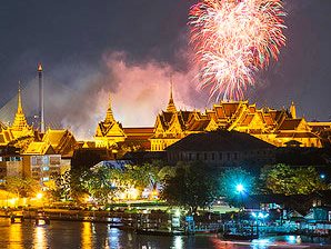
The Grand Palace, #1
 The dazzling Grand Palace is the most famous landmark in Bangkok. It was built in 1782 and for 150 years was home of the Thai King, the Royal court and the administrative seat of government. Within its walls were also the Thai war ministry, state departments, and even the mint. Today, the complex remains the spiritual heart of the Thai Kingdom. Within the palace complex is also Wat Phra Kaew (Temple of the Emerald Buddha), which contains the greatly revered Emerald Buddha that dates back to the 14th century. The Grand Palace, with the Temple of the Emerald Buddha, is Thailand’s most sacred site. Visitors must be properly dressed before entering the temple.
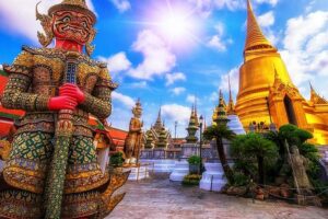 There were a few words I had to get the hang of before I began touring. I learned that “Wat” is a temple. “Stupa” is a bell-shaped tower containing a relic chamber. “Wihan” is a shrine hall that contains the principal Buddha images. Not knowing all the words doesn’t detract from the beauty of the temples, or dampen my appreciation for what they mean to those who worship there, but it’s nice to make a connection, as I did when visiting the mosques in Morocco last year, or standing in the shadow of Uluru a few days ago.
 So let’s review: a wat is a temple; a stupa is a bell-shaped tower, and a wihan is a shrine hall containing Buddha images. Got it? Can you pick out the stupas?
Wat Arun. Wat Benchamabophit. Wat Phra. Wat Saket. As I read about these sacred places, which attract tourists because of their architecture and beauty, I tried to narrow my visits to just one more. But how to choose? If you can’t do it all, Hotel.com suggests a sunset dinner cruise to see the temples along the river; Wat Arun looks magical, illuminated against the night sky.
Chao Phraya: The River of Kings, #2
 You know I love rivers. My hotel room overlooks this river, and has restaurants beside this river. I will get on this river, likely in several different ways. There are ferries and tour boats and longtail boats that even go to the canals. This river, named by King Rama I, is the lifeblood of Bangkok. Around 50,000 people use the ferries to get around each day. Slow cargo barges coast upstream. Kids frolic in the russet-brown water. Wooden shacks lurch over the riverbanks. Soaring hotels hem in solemn temples. Wooden sampans sell noodle soup to hungry river workers. It is calm and chaotic, modern and traditional, religious and secular, ugly and sublime, foreign and indigenous. I will enjoy the Chao Phraya every day I’m in Bangkok.
Siam Niramit, #3
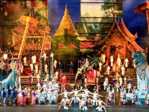 Billed as one of the largest stage productions in the world, Siam Niramit brings back the glorious past of Thailand with a spectacular 90-minute show. The colossal 2,000-seat Ratchada Theatre’s stage occupies more than half the theater space, built to accommodate the show’s monumental set pieces and a legion of performers, including real elephants and goats, recreating the ambience of Siam. The show covers 700 years of Thai history, structured in 3 acts: Journey Back into History, Journey Beyond Imagination: The Three Realms, and Journey Through Joyous Festivals. The Siam Niramit compound houses the theater, a miniature Thai village, and a restaurant; it’s decked in contemporary Thai style with small salas (gazebos); you can also feed the elephants!
Those are my Top Three choices. I will never make it to 67.
PS Those 11 Best Thai Restaurants? More numbers.
- Baan Home Cuisine, real Thai family cooking, Chef Ton brought recipes from his childhood, traditional ingredients and cuisine.
- Bo.Lan Restaurant, recognized for many years as one of the best Thai restaurants in Bangkok, not your everyday local eatery.
- Issaya Siamese Club is a 100-year-old house in the middle of a luscious green garden; exceptional service and the culinary flair of Chef Ian Kittichai.
- Long Table, for appetizers 5 deep-fried tiger prawns lined up in a row, served on a fried betel leaf, with crispy, browned lemongrass sprinkled on top, distinctly Thai.
- Nahm Restaurant, Thai cuisine prepared according to ancient recipes, a Michelin-star chef.
- Saffron at Banyan Tree, high above the city on the 52nd floor of the Banyan Tree Hotel, fantastic views, delicious food.
- Sala Rim Naam at the Mandarin Oriental, amazing riverside location, legendary Mandarin Oriental service, truly great food.
- Steve Café and Cuisine, riverside location with no tall buildings blocking the view, old-fashioned wooden boats passing by, very Thai food, quality ingredients.
- Supanniga Eating Room, an old shophouse with outside terrace, owner Eh serves traditional Thai dishes from his grandmother’s recipes.
- Thanying Royal Cuisine, fresh ingredients, elegant presentation, set in a charming classic house with a small shaded terrace on the side.
- The House Of Smooth Curry, traditional Thai dishes, service and food quality are 5-star but the atmosphere is unstuffy.
Can you possibly pick just three?
» posted on Wednesday, August 3rd, 2022 by Linda Lou Burton
Number Seven
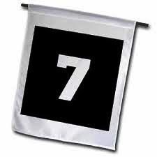 Originally Published August 2, 2020 by Linda Lou Burton posting about Bangkok, Thailand from Little Rock, Arkansas – When I stepped off the plane at Bangkok’s airport yesterday, there should have been fireworks or marching bands. At the least I should have waved a little flag with Number 7 on it. Because, drum roll here, I was finally on Continent Number Seven! I was in my 60s before I ventured out of North America, with my trip to Antarctica via South America. And in my 80s when I got to Europe and Africa last year. Don’t wait that long to see the world! The world is a book and those who do not travel read only a page, Saint Augustine said a very long time ago. Travel is an eye-opener; it takes you out of yourself, I believe, and gives you more space for living your life. So, as soon as the lid on travel due to COVID-19 is lifted, get out and go. Meanwhile, it doesn’t hurt to imagine, and to learn about the rest of the world, as I am doing with my NDI RTW.
I was curious as to where in the world most travelers do tend to go and found a map based on data collected by the United Nations World Tourism Organization (UNWTO). It doesn’t show Antarctica numbers; when I was there in 2005 it was estimated that only 250,000 people had ever set foot there. People fly over it, from New Zealand and Australia in particular. And every year in recent times about 14,000 people get there on a cruise ship. But restrictions only allow 100 people to go ashore at any one time, so I’d say far less than half a million people have ever walked on Antarctic soil.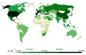
As you can see from the map, most tourists head for Europe or the US, but Asia racks up big numbers too, especially China. And Thailand! Especially Bangkok. In 2019, Bangkok ranked 1st (surpassing Paris and London) in Mastercard’s list of “Global Destination Cities” with over 22 million visitors annually. https://ourworldindata.org/tourism
So let’s focus on that chunk of the world for today.
Asia
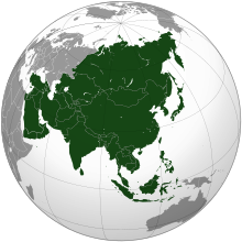 Asia is Earth’s largest and most populous continent, though it is a bit hard to define, as it shares the landmass of Eurasia with Europe, and the landmass of Afro-Eurasia with both Europe and Africa. But within politically drawn lines are about 17+ million square miles and roughly 4.5 billion people. Within those square miles is an expansive range of climates – the equatorial south, the subarctic and polar areas in Siberia, hot deserts in the Middle East, and a temperate center. And those 4.5 billion people represent an enormous variety of ethnic groups, cultures, environments, economics, historical ties and government systems. And don’t forget – Asia was the birthplace of the world’s mainstream religions: Buddhism, Christianity, Confucianism, Hinduism, Islam, Judaism, as well as many other religions.
There are 49 countries in Asia. Thailand is the talk today.
Thailand
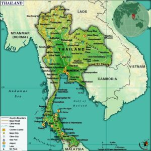 Thailand is the 14th largest country by area in Asia, with 198,000 square miles divided into 76 provinces where 66 million people live. Once called Siam, it is bordered by Myanmar (once called Burma), Laos, Cambodia, Malaysia, the Gulf of Thailand, and the Andaman Sea.
Thailand is a constitutional monarchy and parliamentary democracy; however, in recent history, its government has experienced multiple coups and periods of military dictatorships. After WWII Thailand became a major ally of the United States, periodically alternating between democracy and military rule. The most recent coup in 2014 established its current and 20th constitution. Despite sporadic changes in leadership, Thailand has a high level of human development. Its manufacturing, agriculture, and tourism make it the 20th-largest economy in the world. The capital and largest city is Bangkok, a special administrative area.
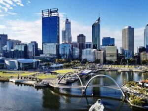
Bangkok
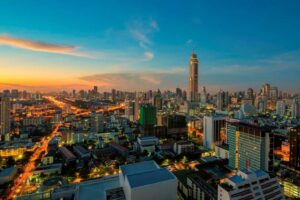 Over 8 million people live in Bangkok; 14 million in the surrounding metro area. The city covers 606 square miles in the Chao Phraya River delta in central Thailand. It began as a small trading post during the Ayutthaya Kingdom in the 15th century; today it is a regional force in finance and business. It is an international hub for transport and health care and is a center for the arts, fashion, and entertainment. It is known for its street life and cultural landmarks; also its red-light districts. Rapid growth and little urban planning have resulted in a haphazard cityscape and inadequate infrastructure. Too few roads and too many private cars have caused crippling traffic congestion and severe air pollution. The development of public transportation is attempting to solve the problem, but congestion is still an issue.
The Fun Stuff
Next post I’ll concentrate on the beautiful things I see in Bangkok, not a word about congestion, I promise! We’ll visit the temples, palaces, museums, and parks, and maybe, though I am not a shopper, some of the famous markets, such as Chatuchak Weekend Market, Sampeng Market, Yaowarat, and Phahurat night market.
Life on Number Seven awaits.
https://www.tourismthailand.org/Destinations/Provinces/Bangkok/219
» posted on Tuesday, August 2nd, 2022 by Linda Lou Burton
Pad Thai Tonight
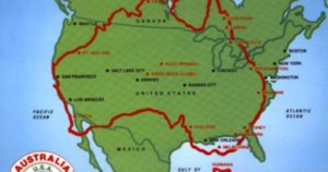
Originally Published August 1, 2020 by Linda Lou Burton posting about Bangkok, Thailand from Little Rock, Arkansas – Big changes afoot. Today I leave things familiar and plunge into things unknown. At least, less 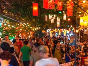 familiar, because so far everywhere I’ve been on the NDI RTW has had “the British touch.” Today I move from the Southern Hemisphere to the Northern; winter to summer; a large county to a small one. The pace changes from easy-going to teeming; more activity, noise, and more people. Australia’s population density is 8. Thailand’s is 348.
The change begins at 9:20 this morning when I board Thai Airlines at Perth International Airport (PER). Then a direct flight to Bangkok, traveling 3,316 miles over the Indian Ocean, Indonesia, the Equator, Singapore, and the Gulf of Thailand before setting down at Bangkok’s Suvarnabhumi Airport (BKK) at 3:20 this afternoon. Bangkok is latitudinally in line with Guatemala and Honduras in Central America so I’d expect hot and humid since it’s August, but the temp today is only 89, with light rain.
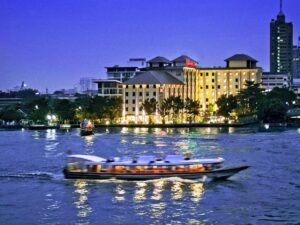
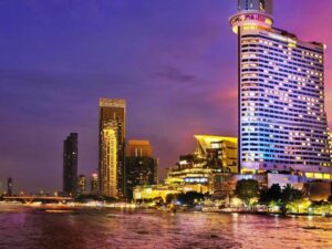 The airport is 37 miles from my hotel in downtown Bangkok, so I made specific arrangements in advance for transportation, no hailing down a last-minute cab for me. I’m booked at Bangkok’s Millennium Hilton, 123 Charoennakorn Road, overlooking the Chao Phraya River. Their blurb states it “offers breathtaking views of the city from every one of its 533 rooms.” I chose a panoramic executive suite, a cowardly move in case I’m so overwhelmed with all the differences I’ll face I can just stare at the city from up high.
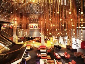
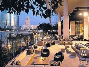 I won’t even need to leave the hotel to eat, look at what they say about their dining facilities: Millennium Hilton Bangkok’s contemporary and cutting-edge style extends to its range of dining options all complemented by expansive views of the river, making the hotel’s award-winning restaurants and bars a preferred destination. With a wide range of seven food and beverage outlets to choose from, FLOW, Prime, Yuan, ThreeSixty Jazz Lounge, ThreeSixty Rooftop Bar, The Lantern, and The Beach each offer their distinctive take on local or international dishes and cocktails to suit every palate, in beautiful indoor and outdoor settings.
Why have I come to Bangkok in the first place, if it seems so hard to tackle? For one, it is on my Ten Superlative World Capital Cities list. Wellington is the “southernmost capital city in the world;” Bangkok has the “hottest climate.” On average, over a year, with all the climatological record keeping, of course.
 But there is another reason I’ve come to Bangkok. I absolutely, positively, without apology, LOVE Pad Thai, the national food of Thailand. It doesn’t matter if you spell it Pad Thai or Phad Thai or Phat thai or whether you add chicken or shrimp or crab or use fish paste or soy sauce or even what degree of hotness you choose, it is simply good. It made #5 on a list of “World’s 50 Most Delicious Foods” in a CNN readers’ poll a few years back, and it has been on my list since I first tasted it in Seattle in the 1980s. I worked with many people from Thailand at the University of Washington, and our department was notorious for potlucks. Not only did I eat lovingly-home-cooked Pad Thai; the substantial Thai population in Seattle also meant good restaurants. I was hooked on Thai food.
But it wasn’t just Thai food I came to love, it was Thai people. I made so many friends over the years; heard so many stories of Thailand; was issued so many invitations to come and visit – Bangkok, Chiang Mai, the whole country. Everywhere in my house are gifts and mementos given to me in kindness – the elephant bracelet, the delicate silk purse, the embroidered wall 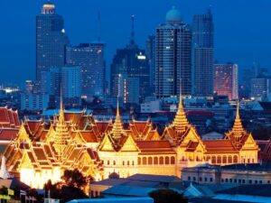 hanging showing mountain people gathered by the fire; the tiny rose intricately carved in scented soap by a friend’s mother.
So even though the architecture may be different, and the language (and long, long words) may be different, and the fast pace of traffic and honking horns and politics and life in general may scare the liver out of me, I will not stay in my hotel room for four days. I will explore this city, and talk with everyone who will talk with me (in English!). I will love it. And I will eat a lot of Pad Thai.
In Case You Don’t Know What Pad Thai Is
 Rice noodles stir fried with eggs and chopped firm tofu, flavored with tamarind pulp, fish sauce, dried shrimp, garlic or shallots, red chili pepper and palm sugar; served with lime wedges and chopped roasted peanuts. It may contain bean sprouts, garlic chives, pickled radishes, turnips, and raw banana flowers; also shrimp, crab, squid, chicken or other animal proteins of choice. Often ingredients are on the side as condiments, such as the red chili pepper, lime wedges, roasted peanuts, bean sprouts, spring onion and other fresh vegetables. Vegetarian versions substitute soy sauce for the fish sauce.
Pad Thai Is Not An Ancient Dish
Stories vary about how this national favorite came to be; I cannot verify but share two of them with you. They sound political, but no matter how the recipe evolved, people everywhere have come to love it!
Pad Thai was created in the 1930s in Thailand by Plaek Phibunsongkhram, the Prime Minister. Thailand was focused on nation building at the time so this dish using Chinese noodles was a way to galvanize nationalism. OR. During World War II, Thailand suffered a rice shortage due to the war and floods. To reduce domestic rice consumption, Prime Minister Phibunsongkhram promoted consumption of noodles instead. The original recipe did not contain pork because of the perception that pork was a Chinese meat.
Believe it, or not.
» posted on Monday, August 1st, 2022 by Linda Lou Burton
What Would You Do?
 Originally Published July 31, 2020 by Linda Lou Burton posting about Perth, Australia from Little Rock, Arkansas – Slept last night at “the famous Cottesloe Beach Hotel.” It promised “near Perth accommodation, bars and dining, and a stunning beach location with Indian Ocean views.” Well, that’s just what I came for. A place to wade in the Indian Ocean. A balcony so I could watch the sun set over said ocean. Restaurants right in the hotel, so I wouldn’t have to step beyond. And of course, that worked out perfectly since this is my Now Defunct strictly Imaginary RTW.
Now it’s Friday morning and my “wander bug” wants to do more than gaze at the ocean today. I’ve come this far, what else can I see in this isolated city, so far from the rest of the world? In one day. Grayline Day Tours has the answer. https://www.grayline.com.au/australia-sightseeing/perth-day-tours/
 Here’s their spiel. Perth enjoys more hours of sunshine than any other city in Australia and locals very much enjoy a relaxed outdoor lifestyle. The city is nestled between the Swan River and Kings Park, one of the world’s largest inner city parks. Half an hour away is the colourful port city of Fremantle renowned for its arty and alternative types. You’ll fall in love with its charm.
For $69 AUD (that’s $49 US, if you want to keep up) their City Highlights Morning Tour takes me to:
- The WACA – Western Australia cricket ground
- Kings Park – spectacular views over Perth skyline, Swan River, and Melville Water from the tree top walk
- Cottesloe Beach on the Indian Ocean coastline
- Stunning and historic Fremantle – docks, marinas, charming heritage sandstone buildings
- Barrack Street Jetty
- The Swan Bell Tower
- Perth Mint – stunning sandstone colonial architecture
- Upmarket suburbs of Peppermint Grove and Dalkeith
- Old Swan Brewery and Royal Perth Yacht Club – once home to the America’s Cup
They also offer the Morning Tour With River Cruise, the Grand Perth and Fremantle Tour which includes a river cruise, tram ride, and wine tasting; or the Wildflower Tour. Oh yes, WA is nicknamed the Wildflower State!
I do like wildflowers, but nuts, that is a springtime thing. So what else, Grayline?
The Desert
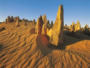 Pinnacles Desert Day Tours: The weird but wonderful formations of the Pinnacles are found in Nambung National Park, 125 miles north of Perth. The limestone structures, some as high as 6 feet, were formed 25,000 to 30,000 years ago after the ocean receded and left deposits of sea shells, gradually leaving the Pinnacles exposed to the elements. Three Tours – Pinnacles Explorer, Sunset and Stargazing, 4WD Adventure.
The Giants
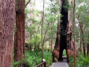 Valley of the Giants Day Tour: Southeast of Perth 250 miles is the Valley of the Giants, named for its large red Tingle trees (Eucalyptus jacksonii) and Karri trees (Eucalyptus diversicolors). Walk across the tree tops in the forest canopy 130 feet up and walk among the gnarled twisted trunks in a gloomy forest glade. On the way ride through riverside suburbs and yacht clubs south of Perth; see orchards around Donnybrook – home of the Granny Smith apple; see the stunning coastline of William Bay.
The Island
 Rottnest Island Day Tour: A short ferry ride from Perth is West Australia’s island getaway. Pristine beaches and bays, stunning scenery, impressive marine life, a rich cultural and historical heritage. Highlights: stunning coral reefs and crystal clear waters. Quokkas – adorable animals that are world renowned as the happiest animal on earth. Cape Vlamingh for whale watching. The Oliver Hill Guns and Tunnel fortification. Stunning pink salt lakes.
The River
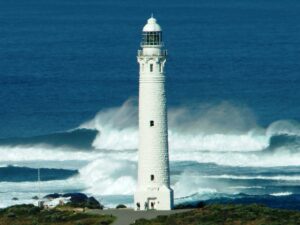
 Margaret River Day Tours: Taste the wines and explore vast underground limestone caves along the Indian Ocean coastline. Brilliant surf, pristine beaches, exceptional wines, decadent food and remarkable caves. The inland waterway of Peel Inlet, blue mountains in the distance, the wine growing region of the South West. Drive through the Karri tree Boranup Forest. Stop at Cape Leeuwin Lighthouse at the most southwesterly tip of Australia, marking the meeting point between the Southern and Indian Oceans.
The Valley
 Swan Valley Day Tours: A picturesque region on the upper reaches of the Swan River 25 minutes east of Perth. The oldest wine growing area in Western Australia, over 150 places to wine and dine including award-winning vineyards and restaurants. Morning tea with the Captain, commentary on the Swan River’s history, a first wine tasting on board, then disembark and spend the afternoon at Sandalford Estate, a prominent winery in the Swan Valley.
The Wave
 Wave Rock Day Tours: Wave Rock is composed of multi-coloured granite shaped over time by the gradual erosion of the softer rock below the upper edge and is believed to be over 2,700 million years old. Out in the wide sky wheat plains, Wave Rock, Hippo’s Yawn, and other strange rocks protruding from arid soil show the real Australia, ever waiting for life-giving rains. The route: Cross the Swan River Causeway. Climb the Darling Ranges. Cross vast dry farming plains. Visit historic York, the centre of the Avon Valley. Look for crows, cockatoos and galahs. The wheat belt towns of Corrigin, Hyden and Wave Rock. The Humps and Mulka’s Cave, ancient Aboriginal cave paintings. Farms and big horizons. Superb views of Perth’s evening lights from the majestic Darling Ranges on the return.
Back up, rewind! I need to rethink my stay in Australia. I can’t leave till I’ve done all of the above. Which tour do you think I’ll pick first?
 Answer: a no brainer. I pick the Margaret River Day Tour – the coastline, the beaches, the inland waterways, the forest, the limestone caves, the wines, the food, and the KICKER — Cape Leeuwin Lighthouse at the most southwesterly tip of Australia, marking the meeting point between the Southern and Indian Oceans. TWO OCEANS!
And then I’ll stay another week or two and do the rest. What would you do?
Perth Tourism has some suggestions too. https://www.australia.com/en-us/places/perth-and-surrounds/guide-to-perth.html
» posted on Sunday, July 31st, 2022 by Linda Lou Burton
Looking For Ocean
 Originally Published July 30, 2020 by Linda Lou Burton posting about Perth, Australia from Little Rock, Arkansas – I told you it was a big country. If you want to imagine Australia-size against United States-size, my Canberra-Perth flight today (on my NDI RTW) is similar to traveling from Washington DC to Los Angeles via Atlanta, as I have a layover in Melbourne again. It looks like four hours, when you think of local times, but I’m crossing several times zones, so I resolve the issue by just not thinking about how long it takes. Even though it’s winter and gets dark in Perth about 5:30 PM, I’ll be happily settled at my hotel by then. In time for a beach walk right outside my door. And a toe wiggle in the Indian Ocean. It won’t be warm. Nor will it be cold. When it comes to latitude, Perth is similar to New Orleans, or north Florida.
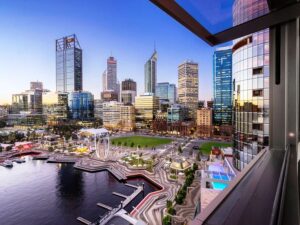 Perth is a city of about 2.14 million sun-loving people, named after a city in Scotland, and capital of Western Australia. Like California, a rush to the area happened due to the discovery of gold in the late 19th century; during WWII it was a base for submarines operating in the Pacific; after the war there was a surge of immigrants. More mining booms in recent years; Western Australia produces more than 50 different minerals from about 1,000 operating mines; the Super Pit Gold Mine is the largest in terms of scale. Perth is regional headquarters for several large mining operations. And of course as capital of an Australian state, the state’s Parliament and Supreme Court are here, along with Government House, the Governor’s residence.
One of the most interesting facts about Perth is that it is one of the most isolated major cities in the world! It is closer to Jakarta, Indonesia, 1,900 miles away, than it is to Sydney, 2,100 miles to the east. And if you head straight west, you’ll cross 5,400 miles of Indian Ocean before you reach South Africa.
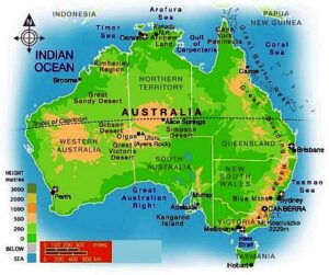 I mentioned earlier than Western Australia makes up a third of the entire country of Australia; it has 8,000 miles of coastline touching two oceans; it has a chunk of desert land too. The Great Victoria covers 134,650 sq miles in WA and SA; the Tanami covers 71,200 sq miles in WA and NT. The Great Sandy (103,900 sq miles), the Gibson (60,000 sq miles), and the Little Sandy (43,100 sq miles) are completely within WA. If you want to compare again, the US Mojave Desert covers 47,877 sq miles. So lots of water in Western Australia, and lots of not.
This part of Australia is an ancient land. There’s been virtually no mountain-building since the rifting from Antarctica, so most of the state is low plateau, except for the Darling Scarp running north to south east of the coastal plain and Perth. Averaging about 1,900 feet in elevation, it is a mild-mannered mountain range, except, it doesn’t seem to like airplanes. Especially in the summertime, strong easterly winds present serious issues for planes using the Perth Airport. Wind shear! Let’s hope my winter landing is calm.
That’s about all I can tell you about Perth right now; tomorrow I’ll play tourist and talk about the fun stuff.
And that Indian Ocean, one more Bucket List item, done and checked.
» posted on Saturday, July 30th, 2022 by Linda Lou Burton
City in a Landscape
 Originally Published July 29, 2020 by Linda Lou Burton posting about Canberra, Australia from Little Rock, Arkansas – My last post was about a beautiful building; this one focuses on the beautiful city in which that building sits, Canberra, Australia. It takes a lot of thinking, planning, and arguing for “what is best” when building a city. Washington, DC is a good example of that, beginning with George Washington’s appointment of Pierre Charles L’Enfant to design a capital city, and what happened over the years after that. Here is Canberra’s story of Charles Scrivener, Walter Burley Griffin, Marion Mahoney Griffin, and Charles Weston, and what happened over the years.
About Charles Scrivener
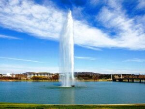 Charles Scrivener was the New South Wales Government Surveyor back in 1908 when the Canberra area was chosen by Parliament as a site for Australia’s future capital city. The Canberra valley, set in an amphitheatre of hills, was chosen because it had “a bracing climate, good water supply, and natural beauty.” Scrivener’s task was to explore the area and prepare a contour survey, which he did; he also suggested four possible points along the Molonglo River where dams could be constructed to create ornamental waters. Fast forward to 1964. Scrivener Dam was inaugurated, creating Lake Burley Griffin, an ornamental body of water in the center of Canberra.
About Walter Burley Griffin and Marion Mahoney Griffin
 Walter Griffin was born in Chicago, studied architecture at the University of Illinois, and for a time worked with Frank Lloyd Wright. He eventually set up his own practice and from 1899 to 1914, created more than 130 designs for buildings, urban plans and landscapes in Illinois, Iowa, Michigan and Wisconsin. In 1911 he married Marion Mahony, an MIT graduate in architecture. They were on their honeymoon when they heard of the international competition held by the Australian Commonwealth Government to produce a design for its new capital city. They worked feverishly to prepare their entry; Marion presented Walter’s designs in a series of vivid drawings showing a city nestled into hills and valleys. In May 1912 their design was selected as the winner out of 137 entries.
 Walter’s winning design showed a chain of lakes along the Molonglo Valley and a triangular framework for a central national area laid out along major vistas. Marion’s drawings showed a new type of Australian town plan, where buildings, roads and gardens could work together to make a picturesque and livable city. The geometric pattern, developed from the topography of the land, had long tree-lined avenues and boulevards and incorporated significant areas of natural vegetation.
Griffin was appointed Federal Capital Director of Design and Construction in 1913, and moved to Australia to supervise the detailed planning of his modern city. But lack of money, the intervention of the First World War, and bureaucratic obstacles made it difficult to realize his plan. Many of his main avenues and parks were laid out at that time, but due to differences with the administration and his own uncompromising vision, Griffin left Canberra at the end of 1920 to work elsewhere in Australia.
In 1924 the government gazetted the Griffins plan for Canberra so that no changes could be made without the approval of Parliament. This protection ensured that the plan for the city remained essentially as Griffin intended it to be — a logical expression of the site. The strength of Griffin’s design is its adaptability to grow and change.
Griffin was largely under-appreciated during his time in Australia, but recognition of his work has steadily grown. In 1964, when Canberra’s central lake was filled by the construction of Scrivener Dam, it was named Lake Burley Griffinr.
About Charles Weston
Charles Weston was an English-born horticulturist who pioneered the greening of the area and its surrounding hills. European settlement after the 1820s had a significant impact on the site; of principal concern was the destruction of tree cover on the hills and the consequent degradation of the shallow soils; there was widespread water and wind erosion. Weston faced a challenging task; an added problem was the conflict between Griffin and Weston over choices of suitable tree species. In all, between 1913 and 1926, Weston was responsible for the planting of two million trees and shrubs.
When Weston arrived in 1913, he assessed the suitability of a wide range of exotic and indigenous trees and shrubs for the site and devised the best methods of planting. He established an arboretum to test the growth of trees; by 1920 almost 45,000 trees had been planted there; it is still in use today. He next turned his attention to rehabilitating degraded hill areas. Between 1915 and 1924 he treated over 2,500 acres of public land. He took the first steps in the conservation of the ACT’s rural landscape. He laid down a set of conditions to achieve control over the lopping of vegetation for fodder and the killing of trees by ring-barking. In addition, he issued free trees to landholders.
 He created a special landscape character for the streets, avenues and parklands of the emerging city, achieving strong seasonal color effects and protection from the bitter cold and hot dusty winds.
The legacy of Charles Scrivener, Walter Burley Griffin and Marion Mahoney Griffin, and Charles Weston is the creation of Canberra as a city in the landscape.
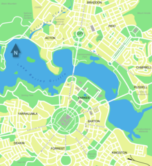
As of June 2019 the population of this city in a landscape named Canberra was 426,704. Located 93 miles inland from the coast near the Brindabella Ranges, it covers an area of 314 square miles at an elevation of approximately 1,900 feet; the highest point is Mount Majura at 2,913 feet.
It’s a really pretty place, you should visit.
 Visit Canberra https://visitcanberra.com.au/
» posted on Friday, July 29th, 2022 by Linda Lou Burton
Nothing Like It
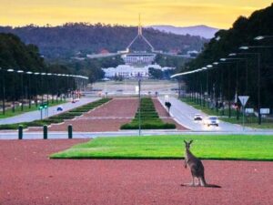
Originally Published July 29, 2020 by Linda Lou Burton posting about Canberra, Australia from Little Rock, Arkansas – I’m a sucker for capitol buildings – on the Journey Across America I always dug into the story of how each state’s capitol came to be; the reasons for the choices made in design, location, and symbols. So natch, the story of Australia’s Parliament House was the first thing I wanted to dig into when I woke up in Canberra this morning (on my NDI RTW). Here’s the story straight from the Australian Government website. https://www.aph.gov.au/
Canberra Has Had Two Parliament Houses
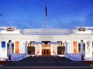 Old Parliament House started life in a rather temporary status. It was named the Provisional Parliament House when government moved from Melbourne to the new capital of Canberra in 1927, designed to serve the needs of Parliament for a maximum of 50 years. It was built in a “Stripped” Classical style common to the 20s and 30s in Australia – no columns or pediments, but the symmetry associated with neoclassical architecture.
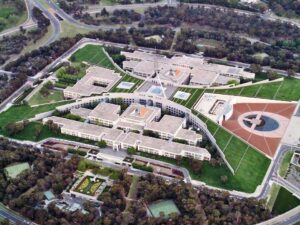
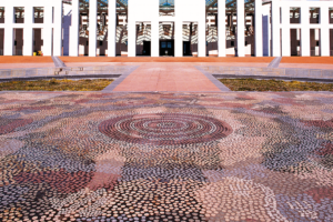
By the 1970s the building had exceeded its capacity and was in need of considerable repair and renovation, so plans for a new Parliament House began. The new building was opened by Queen Elizabeth II in May 1988. I don’t know what the Queen thought about it, but it’s safe to say there is nothing like it anywhere else in the Commonwealth, or for that matter, the world. Its roof is covered in grass, and the shape is, well – two boomerangs. No kidding, look at the aerial view. See the curves? And that flagpole on top is 266 feet high, weighs 275 tons, and flies a flag that is 42 x 21 feet, about half the size of a tennis court. To the right is the forefront and verandah of the building, where the public is welcomed in; a 640 sq foot mosaic by an Aboriginal artist depicts ancient western desert dreaming.
 But the Old Parliament House wasn’t left out; some of the facades of the New included deliberate imitation of some patterns of the Old, so that there is a slight resemblance despite the massive difference of scale. And the Old still stands today; at the base of Capital Hill at the centre of the Parliamentary Triangle, which is the heart of Walter Burley Griffin’s design for the city of Canberra. (More about the city’s design in the next post.)
Here are some numbers to stretch your mind with regard to the scope of the New Parliament House project.
- 320 entries were submitted in the international design competition from which Architects Mitchell/Giurgola & Thorp were chosen
- 7 years were involved in the construction of the new Parliament House
- 10,000 workers were involved in building and fitting out the building
- 300,000 cubic metres of concrete went into the construction of the building
- $1.1 billion AUD was the cost of the new Parliament House
- 79 acres are covered by Parliament House and its landscape setting on Capital Hill
- 4,500 rooms are in Parliament House
- 5,000+ people work in the building when Parliament sits
- 1 million people visit Parliament House annually
- 200 years is how long Parliament House is designed to last
I can only say – it’s worth a trip to Australia just to see this building!
A few words directly from the Parliament House site about the Chambers:
Parliament House is the heart of Australian parliamentary democracy, and one of the most open parliamentary buildings in the world. It was designed to encourage public access and involvement while responding to the Australian climate, landscape, vegetation, and even the quality of the light.
The House of Representatives has 151 members and is the house in which government is formed. The colour scheme of the House Chambers reflects the green associated with British Parliament’s House of Commons and the eucalypt green of the Australian landscape.
The Senate, or upper house, has 76 senators: 12 from each state and two each from the Northern Territory and the Australian Capital Territory. The Senate Chambers reflect the red of British Parliament’s House of Lords and the shades of ochre red in the Australian landscape.
The Members’ Hall lies at the centre of Parliament House and is not open to the public. Inlaid on the first floor is a bronze Federation Star, representing each of the states and mainland territories of Australia; flowing water comes into the Reflective Pool.
https://www.aph.gov.au/Visit_Parliament/Things_to_Do/Take_in_some_history
https://www.aph.gov.au/Visit_Parliament/Things_to_Do/Discover_the_architecture
Parliament House Entry
» posted on Thursday, July 28th, 2022 by Linda Lou Burton
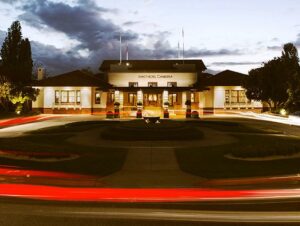
Home Away From Home
Originally Published July 28, 2020 by Linda Lou Burton posting about Canberra, Australia from Little Rock, Arkansas – How about a picture-book post today, as the Now-Defunct-Imaginary ‘Round The World continues? For someone who doesn’t like to fly, I seem to be spending a lot of time in the air, or waiting to get into the air. First there was Little Rock- Seattle-Maui-Hawaii. Then Honolulu-Pago Pago-Apia-Wellington, quite a trick to plan with that dateline crossing. But getting everywhere I wanted to go in Australia took even more fine-tuned planning. The River Murray Tour was only available on Fridays, so, I had to be in Adelaide on a Friday; for the government buildings in Canberra I needed a weekday; there was simply no way to start on one side of the country and go in a straight line!
![]() So from Wellington, it’s Melbourne to Adelaide to Alice Springs to Ayers Rock to Melbourne to Canberra; Northwest and West and North and West and South and Northeast. And there are two more inter-continent flights at the end of the week! Australia is all Qantas, with its cute kangaroo logo, quite appropriate for hopping around the continent.
So from Wellington, it’s Melbourne to Adelaide to Alice Springs to Ayers Rock to Melbourne to Canberra; Northwest and West and North and West and South and Northeast. And there are two more inter-continent flights at the end of the week! Australia is all Qantas, with its cute kangaroo logo, quite appropriate for hopping around the continent.
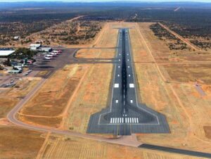
- Melbourne Airport MEL: Australia’s 2nd busiest; 35 million passengers annual; elevation 434 ft; runways 11,998 ft & 7,500 ft
- Adelaide Airport ADL: Australia’s 5th busiest; 8.5 million passengers annual; elevation 20 ft; runways 10,771 ft & 5,420 ft
- Alice Springs Airport ASP: Australia’s 18th busiest; 640,000+ passengers annual; elevation 1,789 ft; runways 7,999 ft & 3,717 ft
- Ayers Rock Airport AYQ: 309,000+ passengers annual; elevation 1,626 ft; runway 8,527 ft
- Canberra Airport CAN: 3 million + passengers annual; elevation 1,886 ft; runways 10,771 ft & 5,509 ft
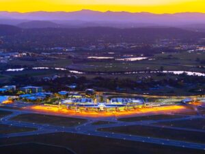
Melbourne Airport
Adelaide Airport
Alice Springs Airport
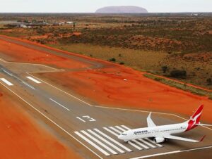
Ayers Rock Airport
Canberra Airport
In order to appease my non-flying psyche, I pacified myself with nice places to sleep, and recover, in between. So here’s my list, look and learn. Need help planning YOUR next trip?
I chose all my hotels based on location and looks. Were they handy to what I wanted to do, and did their “look” fit in with the unique aspects of their location? And in case I was TIRED after all that flying and just wanted to stay put at my hotel, I wanted a view I’d enjoy, and pleasant dining. I may not be a tourist, but I wanted to enjoy every minute of my trip, and that included where I slept, and ate, and collected my thoughts between all those Qantas jaunts.
- Adelaide Hilton, 233 Victoria Square
- Alice Springs Hilton, 82 Barrett Drive
- Ayers Rock Desert Gardens, Ayers Rock Resort
- Hotel Canberra Hyatt, Commonwealth Avenue
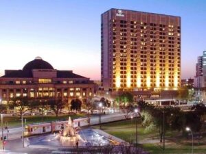
Adelaide Hilton
Adelaide Hilton Lobby

Alice Springs Hilton
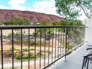
Alice Springs Hilton Balcony
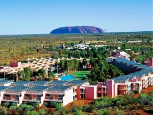
Desert Gardens Resort
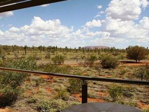
Desert Gardens Balcony
 Canberra Hyatt tonight, an after-dark arrival, dinner and a good nights sleep. Tomorrow: All about Australia’s Capital City!
Note: All these hotels met my requirements perfectly, and I am sad I had to cancel ALL these reservations due to COVID-19. Don’t worry guys, I’ll be there some day.
» posted on Wednesday, July 27th, 2022 by Linda Lou Burton
A Little Culture
Originally Published July 27, 2020 by Linda Lou Burton posting about Uluru, Australia from Little Rock, Arkansas – I established yesterday that it is a major faux pas to climb Uluru. But climbing has been banned only since October 2019, 146 years after William Gosse spotted it and dubbed it Ayers Rock. And 55 years after a chain was planted up its side to help the white ants, as tourists were sometimes referred to by natives, claim victory at the top. The controversy over the use, value, and meaning of the giant monolith is not unlike the controversy in the United States regarding Mount Rushmore. “Meaning” comes from cultural perceptions.
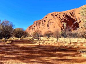
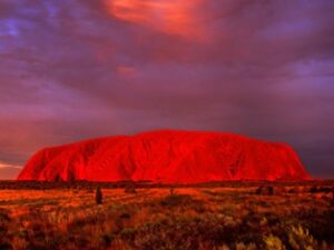 Looking out my window at Uluru, glowing in the morning sun, I see a rock, a really gorgeous piece of nature’s handiwork, a tick off my Bucket List of Natural Wonders of the World. Because I am a respectful person in general, I will honor all restrictions and requests during my visit, and do no harm. I didn’t steal a pebble in Antarctica, or take a sneak photo of Guernica in Madrid.
But what does Uluru mean to a culture different from mine, in this case, the Pitjantjatjara Aborigines; specifically the local Anangu? I started with a Park Fact Sheet, and an explanation of Tjukurpa (pronounced ‘chook-orr-pa’), the foundation of Anangu culture. I learned that, like religions elsewhere in the world, Tjukurpa provides answers to many important questions.
- Tjukurpa is the religious philosophy that links Anangu to the environment and our ancestors. Tjukurpa is the traditional law that tells us how to care for one another and the land that supports us. It tells of the relationships between people, plants, animals and the physical features of the land.
- Tjukurpa stories tell about the beginning of time when ancestral beings first created the world. They tell us where important places are, how to travel from one place to another, and where and when we can find water and food. They contain important lessons about the land and how to survive in the desert as well as rules for appropriate behaviour.
- Tjukurpa is not written down. It is memorised and passed on to the right people like an inheritance. This law was given to us by our grandfathers and grandmothers, our fathers and mothers, to hold onto in our heads and in our hearts.
The Tjukurpa fact sheet https://parksaustralia.gov.au/uluru/discover/culture/tjukurpa/
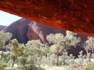
 Uluru holds great spiritual significance as a place where many creation stories converge. It is a meeting place with many pathways and tracks leading to and from it. Each path tells an important story that teaches a vital lesson. Walks follow the tracks of the ancestral beings. The rock’s shapes and textures hold knowledge and stories that have been passed down through generations and are still relevant today.
Mala Walk The Mala people are the Anangu’s ancestors, and their story is one of the most important of Tjukurpa. This walk includes the caves where they camped when they first arrived at Uluru; the kitchen cave where they prepared their meals. Rock art to see along this walk.
Mutitjulu Waterhole Mutitjulu Waterhole is a place to listen quietly to the sounds of the beginning of time. The presence of water means this area is particularly lush and shady. Wallabies wander the tall grasses and river red gum trees. Bush foods abound, tjantu (bush tomatoes), ili (figs) and arnguli (bush plums).
 Kuniya Walk The Kuniya walk is the site of one of Uluru’s most dramatic creation stories – the deadly battle between Kuniya (the woma python woman) and Liru (the poisonous brown snake man). Here, understand how creation stories are played out on the surface of Uluru today. Kuniya and her spirit are here, and the caves she protects are still used by Anangu.
Liru Walk The Liru walk (named after the poisonous brown snake) winds through a mulga forest and connects the Cultural Centre with the base of Uluru; a fantastic place to soak up the solitude, listen to the wind in the trees and contemplate the sheer magnitude of Uluru.
Lungkata Walk Tjukurpa teaches not to steal from others through the story of Lungkata (the cheeky blue-tongue lizard man). Panpalala birds sing, ancestral birds that play a part in the Lungkata creation story. With binoculars or a long lens see hundreds of tiny birds nesting high up in the caves.
Northeast Face Walk The northeast face of Uluru is dotted with sacred sites. According to Anangu culture, the rock formations here hold chapters of creation stories that should only be learned in person. It is inappropriate for any images of these sites to be viewed elsewhere. For these reasons, Anangu request that you enjoy the scenery of the northeast face but do not take any photographs. By following this request, you are ensuring the continuation of Anangu cultural beliefs and the protection of their spirituality.
Put away the camera, be in the moment and experience the calm, peaceful environment that surrounds you. When you return from the park, tell your friends that they have to visit for themselves, because there are some parts of Uluru that you can only see in person.
And so I deliver that message to you today.
Tomorrow I head for Canberra, the national capital. And I’ll tell you more about AIATSIS, the Australian Institute of Aboriginal and Torres Strait Islander Studies, a government agency focusing on the history and culture of Aboriginal Australia.
» posted on Tuesday, July 26th, 2022 by Linda Lou Burton
The Big Red Rock
Originally Published July 26, 2020 by Linda Lou Burton posting about Uluru, Australia from Little Rock, Arkansas – Australian English defines a “walkabout” as a journey (originally on foot) that is made by an Australian Aboriginal in order to live in  the traditional manner. It’s also been defined as a spiritual or ceremonial journey, a rite of passage, a chance to be alone, or the opposite, to wander among people. My NDI RTW is a “walkabout” of sorts, a pause in routine to wander, observe the world, and to think. Like my Journey Across America – two years on the road, just me and the cats, paying attention, learning. I am not a tourist.
What will I learn in my two-night stay near Uluru? I’m booked at the Ayers Rock Resort Sunday and Monday nights, and that puts me into the tourist category I suppose, so I’ll talk about “the naming” issue first; a story of what was, what happened, and what is going on today at the Big Red Rock that means “Australia” all over the world.
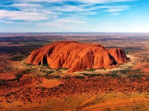 The Big Red Rock is sandstone, 2,831 feet of it; 1,142 feet are above ground. It has a perimeter of 5.8 miles. It appears to change color at different times of the day; it glows red at dawn, and sunset. There are a number of springs, waterholes, and rock caves in the area, which is 208 miles southwest of Alice Springs. It is a UNESCO World Heritage Site and a major tourist attraction. And it is controversial.
Archaeological finds indicate that humans have inhabited the area for more than 10,000 years, but Europeans didn’t arrive until the 1870s. William Gosse, one of the first British explorers in the area, named the Big Red Rock Ayers’ Rock, in honor of the Chief Secretary of South Australia, Sir Henry Ayers. But the people already living there called the Big Red Rock Uluru. It was a sacred place, a part of their creation story.
In a sequence of events much like America’s history, further European exploration followed; resources were documented as land for farming or mining; fences were erected and claims made. The British concept of fences and property boundaries was unknown to Australia’s native population, who lived a more nomadic life, following resources as nature provided. Due to the new restrictions and effects of grazing and drought, bush food stores soon were depleted; competition for resources created conflict. Interaction between natives and white settlers became frequent, and sometimes violent.
Between 1918 and 1921, large adjoining areas of South Australia, Western Australia, and the Northern Territory were declared Aboriginal reserves. The Petermann Reserve included Uluru, or Ayers Rock. In 1940, the Petermann Reserve was made smaller, to allow people to look for gold; in 1958 it was made smaller again when the government created the Ayers Rock-Mt Olga National Park.
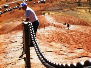 Bill Harney was the first Park Ranger; by 1959, the first motel leases had been granted and an airstrip constructed close to the northern side of Ayers Rock. In 1963, a chain was added to assist tourists in climbing the rock. The development of tourism produced adverse environmental impacts; in the early 1970s all accommodation-related tourist facilities were moved outside the Park. A 40-sq mile area nine miles from Ayers Rock was developed with tourist facilities and an airport; it became known as Yulara. In 1992, the Northern Territory government sold its majority interest in the Yulara resort and it was renamed Ayers Rock Resort. And that is where I’m staying, in a “room with a view,” that allows me to sleep, and wake, with the Big
 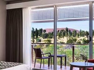 Red Rock watching over me.
Who “owns” the rock today, I wondered. Digging deeper, I learned that in 1985 the Australian government returned “ownership of Uluru” to the Pitjantjatjara Aborigines, with the condition that the local Aṉangu would lease it back to the National Parks and Wildlife agency for 99 years and that it would be jointly managed.
The agreement that the “climb to the top” by tourists would be stopped was not kept. The local Aṉangu do not climb Uluru because of its great spiritual significance. They request that visitors do not climb the rock, partly because the path crosses a sacred traditional Dreamtime track, and also out of a sense of responsibility for visitors safety. Yet until October 2019, the Park Visitors Guide said “the climb is not prohibited, but we prefer that, as a guest on Aṉangu land, you will choose to respect our law and culture by not climbing.”
According to a 2010 publication, just over one-third of all visitors to the Park climbed Uluru; a high percentage of these were children. It is a steep hike, and often quite windy. There have been at least 37 deaths since such recreational climbing deaths were recorded. Several controversial incidents on top of Uluru including a striptease, golfing, and nudity, led to renewed calls for banning the climb. In November 2017, the Uluṟu–Kata Tjuṯa National Park board voted unanimously to prohibit climbing Uluru. There was a surge in climbers and visitors after the ban was announced! But the ban went into effect October 26, 2019, and the climbing chain was removed.
 There are many other trails and walks available in the Uluṟu–Kata Tjuṯa National Park, where close to half a million visitors come every year. Tomorrow I’ll go walkabout, respectfully, at the Big Red Rock called Uluru; the Base Walk that goes around the rock’s circumference. I’ll listen to the stories. I’ll wake up early enough to see the sun rise, and watch the red sunset glow.
And I will dream.
Walks To Read About
https://parksaustralia.gov.au/uluru/do/walks/
https://parksaustralia.gov.au/uluru/pub/visitor-guide.pdf
.